place

Bucks County Community College

1964 establishments in PennsylvaniaCommunity colleges in PennsylvaniaEducational institutions established in 1964Two-year colleges in the United StatesUniversities and colleges in Bucks County, Pennsylvania
Bucks Shield
Bucks Shield

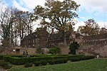
Bucks County Community College (Bucks) is a public community college in Bucks County, Pennsylvania. Founded in 1964, Bucks has three campuses and online courses: a main campus in Newtown, an "Upper Bucks" campus in the town of Perkasie, and a "Lower Bucks" campus in the town of Bristol. There are also various satellite facilities located throughout the county. The college offers courses via face-to-face classroom-based instruction, eLearning classes offered completely online (often referred to as distance learning), and in hybrid (blended) modes that combine face-to-face instruction with online learning. The college is accredited by the Middle States Commission on Higher Education.

Excerpt from the Wikipedia article Bucks County Community College (License: CC BY-SA 3.0, Authors, Images).

Bucks County Community College
Swamp Road, Newtown Township

Geographical coordinates (GPS) Address External links Nearby Places
placeShow on map

Wikipedia: Bucks County Community CollegeContinue reading on Wikipedia

Geographical coordinates (GPS)

Latitude Longitude
N 40.239636 ° E -74.965875 °
placeShow on map

Address

Bucks County Community College

Swamp Road 275
18940 Newtown Township
Pennsylvania, United States
mapOpen on Google Maps

linkWikiData (Q4983461)
linkOpenStreetMap (390260066)

Bucks Shield
Bucks Shield
Share experience

Nearby Places

Council Rock High School North

Council Rock High School North is a high school located in Newtown, Bucks County, Pennsylvania. It is a part of the Council Rock School District. The school is located across from Newtown Middle School and Tyler State Park, and near Bucks County Community College. The current student population is 1,588 for grades 9–12.The school is three stories tall and is divided into an East wing and a West wing. Until 2006, there was no direct connection between the third floors on each wing, so students and staff had to use hallways on the first or second floor to cross between wings. When originally constructed, the school was the only high school in the district and was known simply as "Council Rock High School". As the local population continued to grow, a new high school (Council Rock High School South) was built in Holland, Pennsylvania, which opened in the fall of 2002, and "North" was added to the original school's name. When the new school was opened, middle schools were re-districted as follows: Holland Middle School students attend Council Rock South, Newtown Middle School students and the now closed Richboro Middle School students attend Council Rock North. The school colors are blue and silver, and the school sports teams are known as the Council Rock Indians. After the split in 2002, silver was given to North and gold given to South to distinguish them while still maintaining the two traditional colors of the original high school. The school and the school district are named for Council Rock (also known as Indian Rock), a rock outcropping that forms a cliff in Tyler State Park. This rock was once a council rock for Lenape Indians living in the area.

Tyler State Park (Pennsylvania)

Tyler State Park is a Pennsylvania state park on 1,711 acres (692 ha) in Newtown and Northampton Townships, Bucks County, Pennsylvania in the United States.Park roads, trails, and facilities are carefully nestled within the original farm and woodland setting. Neshaminy Creek meanders through the park, dividing the land into several sections. Before becoming a state park, the land was owned by Mr. and Mrs. George F. Tyler who purchased the land between 1919 and 1928. Their first purchase was the Solly Farm, currently leased to Hostelling International at the north end of the park. The Solly House served as the Tyler's country home until the George F. Tyler Mansion was constructed. The mansion is now the administration building of the Bucks County Community College. The Tylers developed an Ayrshire dairy herd. In addition, they raised poultry, sheep and pigs, and had a stable of about 25 fine riding horses. The croplands were mainly used to supply feed for the livestock. Old original stone dwellings in the park stand as fine examples of early farm dwellings of rural Pennsylvania. Some structures date back to the early 18th century. A date stone (1775) can be found on a house located by the bicycle trail north of the pedestrian causeway in the center of the park. Ten original farm dwellings are currently being leased as private residences. The land for the park was acquired as part of the Project 70 Land Acquisition and Borrowing Act, with the governor approving the acquisition on November 17, 1964. The park was formally dedicated on May 25, 1974.Tyler State Park contains a 36-hole disc golf course and a former landfill, which is now mainly used for archaeological digs by students from Council Rock School District elementary schools. Tyler State Park is home to many different species of birds. The creek is home to water snakes, turtles, and eels. The secluded sections of the park are home to foxes, deer, beavers, wild turkey, rabbits, and coyotes.One of the main attractions in the park is the Schofield Ford Covered Bridge, originally built in 1874. The bridge burned down due to arson on October 7, 1991, but was rebuilt with raised funds and reopened on September 7, 1997.

Newtown Presbyterian Church

Newtown Presbyterian Church, also known as Old Presbyterian Church of Newtown, is a historic Presbyterian church complex and national historic district in Newtown, Bucks County, Pennsylvania. This old edifice is the second of four Presbyterian Church buildings erected in Newtown. The first was built in 1734, and William Tennent, the first minister, preached there one Sunday a month. The first pastor to be installed in Newtown took office in 1752. The church was erected in 1769 and remodeled in 1842. It is a 2 1/2-story, rectangular stone building in the Greek Revival style. A porch and two vestibules were added about 1880.In December 1776, because it was one of the largest buildings in town, General George Washington commandeered it and used it as a hospital, a jail and a P.O.W. “camp.” After the Battle of Trenton, several hundred Hessians were held there before they began their long march to Philadelphia where they would be exchanged for American soldiers. The small building on the south side of the church is the Session House. It was built about 1800, and is a 1 1/2-story, rubble fieldstone structure. It was used as a meeting place for the session, and is one of only two such buildings in the county still standing. Because most early session members were farmers and did not get to town except on Sunday, the Session House provided a quiet place for conducting church business.In back of the church is the church cemetery. It includes eight British flags marking the graves of men who fought in the French and Indian Wars. There are twenty-eight flags flying over the graves of church members who followed General Washington in the American Revolution. The graveyard is partially surrounded by a stone wall.It was listed on the National Register of Historic Places in July 1987.