place

Chinatown, Newark, New Jersey

1875 establishments in New JerseyChinatowns in the United StatesChinese-American culture in New JerseyEthnic enclaves in New JerseyNeighborhoods in Newark, New Jersey
Populated places established in 1875
1910 era ethnic map of Newark, New Jersey

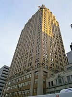
Newark's Chinatown was a neighborhood in the city of Newark in Essex County, New Jersey, United States. It was an ethnic enclave with a large percentage of Chinese immigrants, centered along Market Street from 1875 and remaining on some scale for nearly one hundred years. The center of the neighborhood was directly east of the Government Center neighborhood. The first Chinese in Newark came from the community in neighboring Belleville, home of the East Coast's first Chinese community. The first Chinese businesses appeared in Newark in the second half of the 19th century and in the early part of the 20th century. By the 1920s, the small area had a Chinese population of over 3000.In 1910, a small lane with housing and shopping was built called Mulberry Arcade, connecting Mulberry Street and Columbia Street between Lafayette and Green Streets. In the 1920s, recurring federal opium raids disrupted the community, causing many to move to more peaceful places. Despite an attempt to revive the neighborhood decades later, the Mulberry Arcade (the center of Chinatown) was removed in the 1950s. A 21st century project in the area is called Mulberry Commons. Today there is barely any sign that a Chinatown existed in the neighborhood, and only a small Chinese population remains. There is a Chinese restaurant on Lafayette Street and another on Green St. Nearby, the Sumei Multidisciplinary Arts Center on Liberty Street, in an old factory in the Chinatown neighborhood, exhibits arts from various world cultures.

Excerpt from the Wikipedia article Chinatown, Newark, New Jersey (License: CC BY-SA 3.0, Authors, Images).

Chinatown, Newark, New Jersey
Market Street, Newark

Geographical coordinates (GPS) Address Nearby Places
placeShow on map

Wikipedia: Chinatown, Newark, New JerseyContinue reading on Wikipedia

Geographical coordinates (GPS)

Latitude Longitude
N 40.734771 ° E -74.1681 °
placeShow on map

Address

Market Street
07105 Newark
New Jersey, United States
mapOpen on Google Maps

1910 era ethnic map of Newark, New Jersey
Share experience

Nearby Places

Prudential Center
Prudential Center

Prudential Center is a multipurpose indoor arena in the central business district of Newark, New Jersey. Opened in 2007, it is the home of the New Jersey Devils of the National Hockey League (NHL) and the men's basketball program of Seton Hall University, known as the Seton Hall Pirates. The arena officially seats 16,514 patrons for hockey games and up to 18,711 for basketball. Fans and sports writers have affectionately nicknamed the arena "The Rock" in reference to the Rock of Gibraltar, the corporate logo of Prudential Financial, a financial institution that owns the naming rights to the arena and is headquartered within walking distance of it. In December 2013, the arena ranked third nationally and ninth internationally for self-reported annual revenue. In January 2023, the arena was ranked fifth globally by Pollstar for concert revenue.The arena was built amidst financial concerns and years of speculation that the Devils would relocate, despite the fact that the team was a perennial playoff contender and had been at or near the top of the NHL's standings for over a decade. The arena is located two blocks from Newark Penn Station in downtown Newark, just west of Newark's Ironbound district, which makes it easily accessible via New Jersey Transit, PATH, Newark Light Rail, and Amtrak. At the time of its opening, Prudential Center was the first major league sports venue to be built in the New York metropolitan area since Meadowlands Arena, the Devils' former home, opened in 1981. It is owned and operated by Harris Blitzer Sports & Entertainment (HBSE) and was designed by Populous, with the exterior designed by Morris Adjmi Architects.

Newark Public Service Terminal

The Public Service Terminal was a three-level streetcar station in Newark, New Jersey, owned and operated by the Public Service Corporation, adjacent to the Hudson and Manhattan Railroad's Park Place station. It served as the terminus for streetcar lines from as far as Trenton. Public Service was both a transportation company and a utility, providing electric and gas service to much of northern New Jersey. The six office stories above the terminal served as company headquarters. The terminal, opened on April 30, 1916 was located at the northeast corner of Park Place and Raymond Boulevard at Military Park, a few blocks away from the busy downtown crossing at Broad and Market Streets. It provided an off-street terminal for streetcars, and a central location for riders. The street entrance was between the two track levels, and provided access to the office floors and to both terminals. Most cars used the upper level, reached by a ramp from Mulberry Street on the east side. Some used the lower level, reached on the west side from Washington Street by a two-block Cedar Street Subway. In 1916 the upper level saw 2,050 cars a day and the lower 550 cars, with more than 50,000 fares paid per day. In 1935 the lower level was connected to the newly built City Subway, which ran under Raymond Boulevard adjacent to the terminal, to allow cars to continue to the subway terminal at Penn Station. The eastbound connection passed under the City Subway to avoid a grade crossing. Like most trolley companies, Public Service converted its routes to bus lines during the 1930s. The last streetcar line using the terminal upper level was the #1-Newark line to Exchange Place Terminal in Jersey City, which ended on August 1, 1937. The last on the lower level was the #43-Jersey City line, running to Exchange Place Terminal by a different route, which ended on May 1, 1938. The terminal continued in use for bus routes. The lower level was used until May 1966, and the upper level until 1978. Public Service sold its transportation system to the New Jersey Transit in 1981, consisting of a large network of bus lines and one trolley line, the City Subway. The terminal building was demolished in June 1981 and replaced with the Public Service Enterprise Group headquarters, 80 Park Plaza. The unused Cedar Street Subway from the portal to a wall east of Broad Street still exists. The City Subway tunnel has become part of the Broad Street branch of the Newark Light Rail, emerging at Centre Street.

Lenape Trail

The Lenape Trail is a trail through Essex County, connecting many county parks and reservations, wooded spaces, and historical sites. It begins in Newark, New Jersey and ends in Millburn, New Jersey. It was established in 1982. It is the fifth longest trail in the state behind the Delaware and Raritan Canal Trail, the Appalachian Trail, the completed section of the Highlands Trail in the state and the Batona Trail. The Lenape trail traverses Newark and its suburbs, as well as the Watchung Mountains and Passaic Meadows. Because of the steepness of the Watchung Mountains and the flood-prone nature of the Passaic Meadows, the former basin of Glacial Lake Passaic, these areas have remained much less developed than the rest of the northeastern part of the state. This trail therefore offers hikers an opportunity to see cultural and historical sites of an urban trail, as well as large natural and undeveloped areas. The trail's proximity to New York City and the various ridges it traverses, including Forest Hill, Orange Mountain (part of First Watchung Mountain), and Second Watchung Mountain, offer many views of the skyline. The Lenape Trail forms a segment of the Liberty-Water Gap Trail and incorporates the West Essex Trail, the Lenape Trail's only rail-to-trail section. The Lenape Trail also connects with Morris County's Patriots Path trail system on its western terminus. The Lenape Trail is maintained by volunteers of the New York-New Jersey Trail Conference in partnership with local park conservancies and the Essex County Park System. Full maps of the trail can be found at LenapeTrail.org.