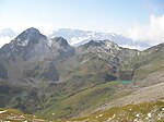
Mazorakopf
FläschGraubünden mountain stubsInternational mountains of EuropeLiechtenstein geography stubsLiechtenstein–Switzerland border ... and 7 more
MaienfeldMountains of GraubündenMountains of LiechtensteinMountains of SwitzerlandMountains of the AlpsTriesenTwo-thousanders of Switzerland

Mazorakopf or Falknishorn (2,451.5 metres [8,043 ft]) is a mountain on the border between Switzerland and Liechtenstein. It is the southernmost point of the principality of Liechtenstein.
Excerpt from the Wikipedia article Mazorakopf (License: CC BY-SA 3.0, Authors, Images).Mazorakopf
Geographical coordinates (GPS) Address Website Nearby Places Show on map
Geographical coordinates (GPS)
| Latitude | Longitude |
|---|---|
| N 47.048477777778 ° | E 9.5569916666667 ° |
Address
Fläsch
7306
Grisons, Switzerland
Open on Google Maps


