place

Bishop Burton College

Further education colleges in the East Riding of Yorkshire
Bishop Burton College

Bishop Burton College is a further education land based college based in Bishop Burton, East Riding of Yorkshire, England.

Excerpt from the Wikipedia article Bishop Burton College (License: CC BY-SA 3.0, Authors, Images).

Geographical coordinates (GPS)

Latitude Longitude
N 53.84826 ° E -0.50405 °
placeShow on map

Address

Bishop Burton College

York Road
HU17 8QG , Bishop Burton
England, United Kingdom
mapOpen on Google Maps

Phone number
Corporation of Bishop Burton College

call+441964553000

Website
bishopburton.ac.uk

linkVisit website

linkWikiData (Q4917504)
linkOpenStreetMap (236121608)

Bishop Burton College
Share experience

Nearby Places

Bishop Burton
Bishop Burton

Bishop Burton is a village and civil parish in the East Riding of Yorkshire, England. It lies on the A1079 road approximately three miles (5 km) to the west of the market town of Beverley. According to the 2011 UK census, Bishop Burton parish had a population of 696, an increase on the 2001 UK census figure of 628.There has been human activity in Bishop Burton for at least 10,000 years, with traces left from the Mesolithic, Neolithic, Bronze Age, Iron Age and Romano-British eras. The village (whose name may derive from Burtone, meaning fortified farmstead) is mentioned in the Domesday Book as belonging to the Archbishop of York and the site of Archbishop's Manor House continued to be the site of Manor Houses up to the demolition of High Hall in 1952. The parish church of All Saints is a Grade II* listed building and its earliest parts date from the late 12th century. The only other surviving religious building is the Wesleyan Methodist Chapel, dating from 1840, which is now a house. There was a school in the village from 1743 to 1986. In a field to the east of the village is one of the medieval stone boundary markers for the sanctuary of Saint John of Beverley that is now a Scheduled Ancient Monument.The look and feel of the village - black and white colour scheme, rustic porches and clay pantiles - are the result of improvements to estate housing carried out by ERB Hall-Watt and Richard Hall-Watt (see below) in the late 19th and early 20th century. Subsequent development has often followed this architectural style to retain the unified feel of the village. It is readily apparent when it has not.Bishop Burton is home to Bishop Burton College, a further education and higher education college specialising in agriculture and equine studies. Bishop Burton is also the home to Bishop Burton United Football Club, formed in 2008 as Wilberforce & Larkin Football Club before moving to the village at the start of the 2009–10 season and changing the name to Bishop Burton United so as to emphasise their link with the village and their new home. Bishop Burton United play in the East Riding County Football League Division 3 with matches taking place on Saturdays with a 2 pm kick off. United's home ground is the 4G artificial surface at Bishop Burton College. United's local rivals are nearby sides Molescroft Rangers and Market Weighton United. United have a reputation as a progressive and ambitious football club with the lofty aim of gaining semi-professional status within the next 7 years. The club is also known for its broad multicultural mix with Polish, Latvian, French, Indonesian and Nigerian players in their squad.

Etton, East Riding of Yorkshire

Etton is a village and civil parish in the East Riding of Yorkshire, England. It is situated approximately 4 miles (6 km) north-west of Beverley town centre and 2 miles (3.2 km) west of the village of Leconfield. 1 mile (1.6 km) to the south-east is Cherry Burton. To the west lie the hamlets of Kiplingcotes (3 miles (5 km) away due west) and Gardham (1.5 miles (2.4 km) to the south-west). South Dalton lies 1.5 miles to the north-west. The village itself lies to the west of the B1248 road in its own shallow dale. The village's buildings are almost entirely situated either side of Main Street. Along this street lie both the village pub and the parish church of St Mary, which is a Grade II* listed building.The civil parish is formed by the village of Etton and part of the hamlet of Kiplingcotes. According to the 2011 UK Census, Etton parish had a population of 277, a decrease on the 2001 UK Census figure of 285.Etton is significant as the 1584 birthplace of Rev John Lothropp, founder of Barnstable, Massachusetts. Several Lothropp family members have death or burial dates recorded as 6 January 1588, but as there is no record of a catastrophic event on that date, it is believed to be merely a recording date to catch up on vital statistics which had gone unreported for some length of time.Thomas Carling, who emigrated from Etton to Canada in 1818, used 'a recipe from his native Yorkshire' to found the Carling Brewery in 1840.Etton is also home to the Holderness Hunt, whose kennels are located on the south-east of the village. In 1823 Etton was in the Wapentake of Harthill. The village had a population of 380, with occupations including nine farmers, two shopkeepers, a carpenter & wheelwright, a boot & shoe maker, a tailor, a corn miller, and the landlord of the Light Dragoon public house. There were two gentlemen, one gentlewoman, a Lady, a vicar, and a schoolmaster who was also the parish clerk. Once a week two carriers operated between the village and Beverley. The patron of the village Church of St Mary was the Archbishop of York.Etton has been known to suffer quite badly during floods, due to its position in a small valley, with the most recent flood on 25 June 2007.

Walkington
Walkington

Walkington is a village and civil parish in the East Riding of Yorkshire, England. It is situated approximately 3 miles (4.8 km) to the south-west of the town of Beverley on the B1230 road, and Beverley Grammar School. The civil parish is formed by the village of Walkington and the hamlet of Broadgate. According to the 2011 UK census, Walkington parish had a population of 2,337, a reduction on the 2001 UK census figure of 2,481.To the east of the village is Broadgate, the site of a former mental hospital, named Broadgate Hospital.Another part of the former Broadgate Farm estate has been developed into a complex of holiday cottages named Broadgate Farm Cottages. The village has three public houses located along the main road, East End, the Barrel, the Ferguson Fawsitt Arms, and the Dog and Duck. Ferguson closed its doors on 4 October 2020 due to the coronavirus pandemic, although it reopened under new owners in early 2022. In the centre of Walkington is the village pond. The village school, Walkington Primary School is situated in Crake Wells, a minor street in the East End of the village. Before the year 1999 the school was divided between two sites which included the original school house at Northgate which dates back to the late 19th century. Before this, the street was called "School Lane". However, after a costly extension to the Crake Wells building, the infant and junior sections were joined together in 1999. The new building was officially opened by then Education Secretary David Blunkett, in October that year.The parish church of All Hallows is a Grade II* listed building. A Methodist church is situated next to West End.

Beverley Racecourse
Beverley Racecourse

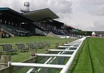
Beverley Racecourse is a thoroughbred horse racing venue located in the town of Beverley in the East Riding of Yorkshire, England. Racing in Beverley can be documented as far back as over 300 years ago, and the founding of The Jockey Club in 1752 really formalised its presence in the town. With the founding of The Jockey Club, the occasional racing at nearby Westwood Pasture was recognised, and Beverley Racecourse was founded. An annual meeting at Beverley was first established in 1767. Before that races had only occasionally been run there. Then, for a short period between 1798 and 1805 racing once again stopped. Later in the 19th century a three-day meeting was taking place annually in the week after York's May meeting. In 2012, Beverley hosted racing on 19 days. Its most prestigious races being two Listed races - the Hilary Needler Trophy for two-year-olds in May and Beverley Bullet Sprint over 5 furlongs in August for three-year-olds and up.The racecourse is a right-handed flat course, that is just over 1 mile 3 furlongs. It is predominantly flat but with a stiff, uphill finish and tight turns. Beverley has the most pronounced "draw bias" on a UK racecourse on its 5 furlong course. The sharp right hand bend and the fact that the ground runs away to the left make a low draw (i.e. on the inside rail) much more advantageous than a high draw (i.e. on the wide outside and on ground sloping right to left).The first grandstand was commissioned for the racecourse on 22 May 1767 at a cost of £1,000. A £90,000 stand was opened in Tattersalls enclosure in 1968.In August 2018, it was announced that planning permission was being sought for a £4.8 million grandstand to replace the existing 1960s structure, with an expected completion of April 2021.It has been described as an "unpretentious but agreeable" racecourse.As of July 2019, 10 horses have died at the racecourse since 2007.

Humberside
Humberside

Humberside () was a non-metropolitan and ceremonial county in Northern England from 1 April 1974 until 1 April 1996. It was composed of land from either side of the Humber Estuary, created from portions of the East Riding of Yorkshire, West Riding of Yorkshire, and the northern part of Lindsey, Lincolnshire. The county council's headquarters was County Hall at Beverley, inherited from East Riding County Council. Its largest settlement and only city was Kingston upon Hull. Other notable towns included Goole, Beverley, Scunthorpe, Grimsby, Cleethorpes and Bridlington. The county stretched from Wold Newton in its northern tip to a different Wold Newton at its most southern point. Humberside bordered North Yorkshire to the north and west, South Yorkshire and Nottinghamshire to the south-west, and Lincolnshire to the south. It faced east towards the North Sea. Humberside was abolished on 1 April 1996, with four unitary authorities being formed: North Lincolnshire, North East Lincolnshire, Kingston upon Hull, and East Riding of Yorkshire. The name has continued in use as a geographical term, mainly in the media, and in the names of institutions such as Humberside Police and Humberside Fire and Rescue Service. These institutions did not change their names mainly due to costs. There were proposals to merge the police force with other Yorkshire forces and then change all the forces' names accordingly. However, these proposals were later ruled out.Humber Enterprise Zone was launched in 2012 to encourage industrial development at 16 sites around the estuary.