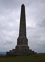
Yatesbury
EngvarB from August 2019Former civil parishes in WiltshireVillages in Wiltshire

Yatesbury is a village and former civil parish, now in the parish of Cherhill, in Wiltshire, England. It is in the northeast of Cherhill parish, 1 mile (1.6 km) north of the A4 road between Calne – about 4 miles (6 km) away – and Marlborough. Yatesbury was an ancient parish and in the 19th century became a civil parish, which was absorbed by Cherhill parish on 1 April 1934. In 1931 the parish had a population of 140. Yatesbury today has a population of about 150. Whilst having no shops or amenities, the village is on National Cycle Route 403. It is noted for RAF Yatesbury, which was an important training centre during World War II.
Excerpt from the Wikipedia article Yatesbury (License: CC BY-SA 3.0, Authors, Images).Yatesbury
Limer's Lane,
Geographical coordinates (GPS) Address Nearby Places Show on map
Geographical coordinates (GPS)
| Latitude | Longitude |
|---|---|
| N 51.444 ° | E -1.906 ° |
Address
Limer's Lane
Limer's Lane
SN11 8YG , Cherhill
England, United Kingdom
Open on Google Maps


