Brodie Mountain
Mountains of Berkshire County, MassachusettsTaconic Mountains

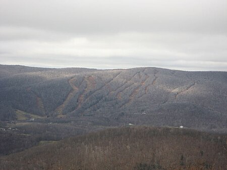
Brodie Mountain, 2,621 feet (799 m), is a prominent 5.5-mile (8.9 km) long ridgeline in the Taconic Mountains of western Massachusetts, known for the former Brodie Mountain ski area, which closed in 2002. The ridge has eight well defined summits, three of which have names: Sheep's Heaven Mountain, 2,530 feet (770 m), the ridge's southern prominatory; Beoadic Mountain, the ridge high point, just north of Sheep's Heaven; and East Mountain, 2,613 feet (796 m) located at the top of the former ski area at the center of the ridge. A northern summit, 2,170 feet (660 m), is shown as "Brodie Mountain" on maps that predate the Brodie Mountain ski area.
Excerpt from the Wikipedia article Brodie Mountain (License: CC BY-SA 3.0, Authors, Images).Brodie Mountain
Geographical coordinates (GPS) Address Website Nearby Places Show on map
Geographical coordinates (GPS)
| Latitude | Longitude |
|---|---|
| N 42.5825 ° | E -73.274444444444 ° |
Address
Hancock
Massachusetts, United States
Open on Google Maps


