place

Gilesgate

AC with 0 elementsAreas of Durham, EnglandCounty Durham geography stubsUnparished areas in County Durham

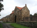
Gilesgate is a place in County Durham, England. It is situated east of the centre of Durham. It is also a ward of Durham with a total population taken at the 2011 census was 8,074.Gilesgate was originally the main street in a settlement associated with the Hospital of St Giles which was sited by the existing St Giles Church. The street was divided in the 1960s by the construction of the A690 and the demolition of a number of houses, pubs and shops at the foot of Gilesgate Bank to construct a roundabout. East of Gilesgate itself was Gilesgate Moor. During the 19th century, housing extended along the Sherburn and Sunderland Roads and the colliery village of New Durham was built within the parish. Additional housing was constructed along the Sherburn Road in the 1930s, including the Sherburn Road Estate, built to house residents from the slums of Framwelgate. Following the Second World War, a further council housing estate was constructed north of the Sunderland Road with the streets taking the names of war leaders and local recipients of the Victoria Cross. In modern usage Gilesgate can refer to the street, the smaller area (partly following old council boundaries) consisting of the street above the roundabout and the Sunderland Road estate, Gilesgate Moor and High Grange Estate.

Excerpt from the Wikipedia article Gilesgate (License: CC BY-SA 3.0, Authors).

Gilesgate
Roosevelt Road, Durham Gilesgate

Geographical coordinates (GPS) Address Nearby Places
placeShow on map

Wikipedia: GilesgateContinue reading on Wikipedia

Geographical coordinates (GPS)

Latitude Longitude
N 54.781111111111 ° E -1.5533333333333 °
placeShow on map

Address

Roosevelt Road 4
DH1 1PR Durham, Gilesgate
England, United Kingdom
mapOpen on Google Maps

Share experience

Nearby Places

St Giles Church, Durham

St. Giles Church is a grade I listed parish church in Gilesgate, Durham, England. The church was constructed as the hospital chapel of the Hospital of St Giles and was dedicated in on St Barbara's Day, June 1112 by Bishop Flambard to "the honour of God and St Giles". The church became caught up in an 1140 dispute over the bishopric of Durham following the usurpation of the diocese by William Cumin, Chancellor of King David I of Scotland. William of St. Barbara, the rightly elected Bishop, was forced to retreat to, and fortify, the church after his abortive entry into Durham was beaten back by Cumin's men. In response Cumin's men destroyed the hospital, which was later refounded at nearby Kepier. Bishop Puiset later extended the church to reflect its role at the centre of a growing parish, and the current font is believed to date from this time. The church was appropriated to Kepier Hospital which acted as rector, receiving tithes and with the advowson (right to appoint a vicar), appointing a parochial chaplain to minister to the needs of the parish. John Heath, the Elizabethan owner of the Kepier estates, Gilesgate and Old Durham is buried in the church. The ecclesiastical parish of St Giles was divided in 1852 with the creation of a new Belmont parish, served from church of St Mary Magdalene, Belmont and covering Belmont, Gilesgate Moor and New Durham. St Giles Church retains some of Flambard's original building (primarily the north wall) and most of Puiset's additions. Minor restoration and three large windows inserted into the south wall in 1828. The church was restored and extended in 1873-1876 as the parish continued to grow. The Revd Canon Dr Alan B. Bartlett is the current vicar of St Giles since Summer 2008.