place

Tielt-Winge

Flemish Brabant geography stubsMunicipalities of Flemish BrabantPages with Dutch IPA
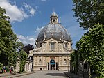
Sint Joris Winge Sint Joriskerk

Tielt-Winge (Dutch pronunciation: [ˌtiltˈʋɪŋə]) is a municipality located in the Belgian province of Flemish Brabant. The municipality comprises the towns of Houwaart, Meensel-Kiezegem, Sint-Joris-Winge and Tielt. On 1 January 2006, Tielt-Winge had a total population of 10,009. The total area is 44.16 km² which gives a population density of 227 inhabitants per square kilometre.

Excerpt from the Wikipedia article Tielt-Winge (License: CC BY-SA 3.0, Authors, Images).

Tielt-Winge
Leuvensesteenweg,

Geographical coordinates (GPS) Address Nearby Places
placeShow on map

Wikipedia: Tielt-WingeContinue reading on Wikipedia

Geographical coordinates (GPS)

Latitude Longitude
N 50.916666666667 ° E 4.9 °
placeShow on map

Address

Leuvensesteenweg

Leuvensesteenweg
3390
Flemish Brabant, Belgium
mapOpen on Google Maps

Sint Joris Winge Sint Joriskerk
Share experience

Nearby Places

N2 road (Belgium)

The N2 road in Belgium is a road connecting Brussels and Maastricht passing Leuven, Diest and Hasselt. It starts in Brussels at the Madou crossroad on the small ring, heading northeast as the Chaussée de Louvain/Leuvensesteenweg, which crosses the municipalities of Saint-Josse-ten-Noode, City of Brussels, Schaerbeek, Evere and Woluwe-Saint-Lambert in Brussels, and then enter Flanders via the municipality of Zaventem, Flemish Brabant. When the road enters the municipality of Herent it is named Brusselsesteenweg up to Leuven. When it leaves Leuven, the road is named Diestsesteenweg as it leads to Diest. It is then named successively Staatsbaan, Leuvensesteenweg, Diestsesteenweg, Staatsbaan, Leuvensesteenweg and Eduard Robeynslaan. When leaving Diest and entering Halen, the road enters the province of Limburg. At this point, the road (named Halensebaan) crosses the European route E314. The subsequent names of the road are: Staatsbaan, Grote Baan, Diestsesteenweg, Steenweg, Diestersteenweg, Kuringersteenweg. Just before entering Hasselt, the road crosses the European route E313. When leaving Hasselt, it is named Diepenbekerweg, then Steenweg, Kapelstraat, Wijkstraat, Grendelbaan, Tipstraat, Beverststraat, Holt, Hasseltstestraat, Brugstraat, Maastrichterstraat, Bilzerbaan and Tweede Carabinierslaan. It then enters the Netherlands. The road crosses in total 19 municipalities. 5 in the Brussels-capital Region, 8 in the province of Flemish Brabant and 6 in the province of Limburg. Full municipality list is available below, main municipalities are in bold.

Aarschot
Aarschot

Aarschot (Dutch pronunciation: [ˈaːrsxɔt] ) is a city and municipality in the province of Flemish Brabant, in Flanders, Belgium. The municipality comprises the city of Aarschot proper and the towns of Gelrode, Langdorp and Rillaar. On January 1, 2019, Aarschot had a total population of 30,106. The total area is 62.52 km2 (24.14 sq mi) which gives a population density of 446 inhabitants per km2. It is located in the part of Flemish Brabant called Hageland, located to the east of Leuven. Aarschot is a very typical town with a long history, dating back to the era of the Roman emperors, according to myths. The church, which dominates the look of the city, is built with the typical brown stone quarried from the hills in the surrounding areas. These same hills were in the Middle Ages home to some of the most well-regarded vineyards of Europe. Today the chain hills, which originate in Bolderberg, Heusden-Zolder, and continue as far as Calais in France, are mainly covered with woods and fruit yards. The title of Duke of Aarschot, created in 1533, is the oldest (not-Sovereign) Ducal title in Belgium (title created for the House of Croÿ, later inherited by the House of Arenberg that still holds it). While the Church of Our Lady (Onze-Lieve-Vrouwekerk) definitely leaves its mark on the appearance of the city, nothing defines Aarschot better than the river that passes through it: the Demer. Aarschot is situated in the valley of this brown-colored river. Aarschot was hit very hard in World War I. When German troops occupied the city on 19 August 1914, Colonel Stenger, commander of the 8th German Infantry Brigade, was shot dead on the balcony of the town hall. The German reprisal was extremely harsh. Many houses were set alight and 156 people were executed, including Mayor Tielemans and his 15-year-old son. The next day, the entire population was ordered to evacuate the city.