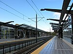
Mount Baker, Seattle
King County, Washington geography stubsNeighborhoods in Seattle

Mount Baker is a neighborhood in southeast Seattle. The neighborhood's name comes from the view of Mount Baker in Whatcom County, that is seen by looking north over Lake Washington. It is bounded by Lake Washington to the east, Interstate 90 and then Leschi to the north, Rainier Valley to the west, and Columbia City to the south. The neighborhood has a community club and a rowing team. It hosts Seattle's annual Seafair, which includes an airshow featuring the U.S. Navy Blue Angels, hydroplane races, a fireworks show, and other festivities. Franklin High School and Garfield High School serve this area. It is part of Seattle's South End.
Excerpt from the Wikipedia article Mount Baker, Seattle (License: CC BY-SA 3.0, Authors, Images).Mount Baker, Seattle
South Dose Terrace, Seattle Mount Baker
Geographical coordinates (GPS) Address Nearby Places Show on map
Geographical coordinates (GPS)
| Latitude | Longitude |
|---|---|
| N 47.583333333333 ° | E -122.29166666667 ° |
Address
South Dose Terrace 3203
98144 Seattle, Mount Baker
Washington, United States
Open on Google Maps


