place

Lake St. Clair Metropark

Beaches of MichiganCoastal resorts in MichiganHuron–Clinton MetroparksLake St. ClairLandmarks in Michigan
Nature centers in MichiganParks in MichiganProtected areas of Macomb County, Michigan

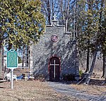
Lake St. Clair Metropark/Metro Beach Metropark is a 770-acre unit of the Huron-Clinton Metroparks system located roughly 20 miles (32 km) northeast of downtown Detroit, Michigan in Harrison Township, Macomb County. Lake St. Clair Metropark has been in existence since 1950 and has seen many changes since then. Originally named St. Clair Metropolitan Beach, it was renamed in 1953 to Metropolitan Beach Metropark and later shortened to Metro Beach Metropark. On December 8, 2011, the Board of Commissioners for the Huron-Clinton Metroparks approved changing the name to Lake St. Clair Metropark. The park is located at Jefferson Avenue and Metropolitan Parkway (16 Mile Road) and there are signs to Lake St. Clair Metropark on Interstate 94 (I-94). Due to sewage overflows, Metro Beach has seen occasional closures caused by high E. coli content in the water. The beach was closed for nine days in 2009 for this reason.

Excerpt from the Wikipedia article Lake St. Clair Metropark (License: CC BY-SA 3.0, Authors).

Lake St. Clair Metropark
Metropolitan Parkway,

Geographical coordinates (GPS) Address Nearby Places
placeShow on map

Wikipedia: Lake St. Clair MetroparkContinue reading on Wikipedia

Geographical coordinates (GPS)

Latitude Longitude
N 42.57569 ° E -82.7993 °
placeShow on map

Address

Metropolitan Parkway
48045
Michigan, United States
mapOpen on Google Maps

Share experience

Nearby Places

Clinton River (Michigan)

The Clinton River is a river in southeastern Michigan in the United States. It is named in honor of DeWitt Clinton, who was governor of New York from 1817 to 1823. The main branch of the river rises from wetlands and coldwater tributaries from within Independence, Brandon and Springfield townships in Oakland County. A series of dams create a number of small lakes west of Pontiac, the last of which is Crystal Lake. The river is piped under downtown Pontiac, re-emerging to the east of downtown. The north branch and the middle branch rise in northern Macomb County and join the main branch in Clinton Township (which was named after the river in 1824). The main branch flows 83.0 miles (133.6 km) from its headwaters to Lake St. Clair in Harrison Township. The Clinton River watershed drains 760 square miles (2,000 km2), including most of Macomb County, a large portion of Oakland County, as well as small portions of Lapeer and St. Clair counties. More than 1.4 million people in over 60 municipalities live in the watershed. For the most part, only the waters located downstream of the city of Mount Clemens are navigable by water vessels. Under the Great Lakes Water Quality Agreement in 1972, along with 42 other areas, the lower segment of the river was designated as an Area of Concern, based on the heavy presence of pollutant contamination. In 1995, the designation was expanded to include the entire watershed of the river and the lower nearshore of Lake St. Clair. The Clinton-Kalamazoo Canal was a failed attempt to build a waterway connecting Lake St. Clair with Lake Michigan. It was originally planned to stretch 216 miles, but was abandoned after only 13 miles had been completed. The French explorers of the late 17th century knew the river as the Nottawasippee, an Ojibwe term that means "like rattlesnakes." This was also the name given to the Huron people by the region's Anishinaabe (Ojibwe, Odawa, and Potawatomi) inhabitants.British fur traders referred to it as the Huron River of St. Clair. It was referred to as "the River Huron" in the 1784 home eulogy of the area's first American settler, William Tucker, who built his home along the river about 3 miles (5 km) upstream from its mouth. It received its current name on July 17, 1824. The Michigan Territorial Council made the change in order to end the confusion between this river and the Huron River of Lake Erie, which also rises in Oakland County's Springfield Township.The Huron-Clinton Metroparks system preserves land in the watershed as public parks; Wolcott Mill Metropark is on the north branch of the river.

Selfridge AFB radar station

The Selfridge AFB radar station is a United States military facility in Michigan. It began operations in 1949 with a Bendix AN/CPS-5 Radar test that tracked aircraft at 210 mi (340 km). A height finder MIT AN/CPS-4 Radar was added by March 9, 1950;[2] and the station was site L-17 of the Lashup Radar Network and site LP-17 of the subsequent network during construction of the Air Defense Command permanent network. The 661st Aircraft Control and Warning Squadron was activated at Selfridge in 1951, and with a pair of General Electric AN/CPS-6 Radars, the station became site LP-20 of the permanent ADC network in 1952. In 1957 the station added a height finder General Electric AN/FPS-6 Radar. The station became part of the Semi Automatic Ground Environment radar network in 1959, supplying radar tracks to SAGE data center DC-06 at Custer Air Force Station, Michigan, for directing interceptor aircraft and CIM-10 Bomarc air defense missiles. By 1960, the AN/CPS-6 radar had been replaced by a Bendix AN/FPS-20 Radar for general surveillance, and the site had an additional General Electric AN/FPS-6A height-finder radar. A Sperry AN/FPS-35 radar installed at the station's tower in 1961 became operational in 1962, and the AN/FPS-6A height-finder was replaced with an Avco AN/FPS-26A Radar c. 1963. On 31 July 1963, Selfridge AFB was redesignated as NORAD site Z-20. The 661st AC & WS also operated Gap Filler sites with Bendix AN/FPS-18 Radars before inactivating on July 1, 1974. The radar station was shared with the United States Army for Nike missile command-and-control. In 1960, Army Air Defense Command Post (AADCP) D-15DC was constructed for coordinating Nike surface-to-air missile launches from numerous Michigan batteries from Algonac/Marine City (D-17) south to Carleton (D-57) & Newport (D-58). The AADCP closed when the Army deactivated the remaining D-06, D-58, & D-87 batteries in April 1974 at Utica, Newport, and Commerce/Union Lake. The former radar station is the location of a United States Marine Corps Reserve unit and the Selfridge Military Air Museum & Air Park. The Missile Master bunker was subsequently used as an air traffic control center manned by the 2031st Communications Squadron. Documents regarding the bunker, demolished in 2005, have been entered in the Historic American Engineering Record.