Battle of Aldenhoven (1794)

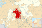
The Battle of Aldenhoven or Battle of the Roer (2 October 1794) saw a Republican French army commanded by Jean Baptiste Jourdan defeat a Habsburg army under François Sébastien Charles Joseph de Croix, Count of Clerfayt which was defending the line of the Roer River. A key crossing was won by the French right wing at Düren after heavy fighting. The Austrian retreat from the Roer conceded control of the west bank of the Rhine River to France. The battle occurred during the War of the First Coalition, part of a wider conflict called the Wars of the French Revolution. Aldenhoven is located in the state of North Rhine-Westphalia in Germany about 21 kilometres (13 mi) northeast of Aachen.
Excerpt from the Wikipedia article Battle of Aldenhoven (1794) (License: CC BY-SA 3.0, Authors, Images).Battle of Aldenhoven (1794)
Alte Turmstraße,
Geographical coordinates (GPS) Address Nearby Places Show on map
Geographical coordinates (GPS)
| Latitude | Longitude |
|---|---|
| N 50.895833333333 ° | E 6.2830555555556 ° |
Address
Alte Turmstraße 7
52457 , Aldenhoven (Aldenhoven)
North Rhine-Westphalia, Germany
Open on Google Maps


