place

Para Wirra Conservation Park

1962 establishments in AustraliaConservation parks of South AustraliaIUCN Category IIIPages with non-numeric formatnum argumentsProtected areas established in 1962
Protected areas in AdelaideUse Australian English from June 2015
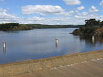
Para Wirra Park Lake and Island

Para Wirra Conservation Park (formerly Para Wirra Recreation Park and Para Wirra National Park) is a 1,417-hectare (3,500-acre) protected area located in the foothills of the Mount Lofty Ranges in the northern end of the Adelaide metropolitan area in South Australia. The conservation park is part of a larger, 2,573-hectare (6,360-acre) block of contiguous native vegetation, the remainder of which is owned by PIRSA Forestry, SA Water and private landholders.

Excerpt from the Wikipedia article Para Wirra Conservation Park (License: CC BY-SA 3.0, Authors, Images).

Para Wirra Conservation Park
Ke12 Track, Adelaide Hills Council

Geographical coordinates (GPS) Address External links Nearby Places
placeShow on map

Wikipedia: Para Wirra Conservation ParkContinue reading on Wikipedia

Geographical coordinates (GPS)

Latitude Longitude
N -34.680671817 ° E 138.830080914 °
placeShow on map

Address

Para Wirra Conservation Park

Ke12 Track
5231 Adelaide Hills Council
South Australia, Australia
mapOpen on Google Maps

linkWikiData (Q7133665)
linkOpenStreetMap (558130)

Para Wirra Park Lake and Island
Share experience

Nearby Places

Sandy Creek Conservation Park

Sandy Creek Conservation Park, formerly the Sandy Creek National Park, is a protected area located in the Australian state of South Australia in the localities of Lyndoch and Sandy Creek about 42 kilometres (26 mi) north-east of the state capital of Adelaide and about 3 kilometres (1.9 mi) west-south-west of the town centre in Sandy Creek.The conservation park consists of land in sections 72, 317 and 319 and in allotments 10, 50 and 202 in the cadastral unit of the Hundred of Barossa.The land first received protected area status in respect to section 72 as a wildlife reserve under the Crown Lands Act 1929 proclaimed on 7 October 1965. On 25 May 1967, sections 317 and 319 were declared as a national park under the National Parks Act 1966 and on 9 November 1967 along with section 72 were named as the Sandy Creek National Park. On 27 April 1972, the national park was reconstituted as the Sandy Creek Conservation Park under the National Parks and Wildlife Act 1972. Since 1972, the following land from the Hundred of Barossa has been added to the conservation park - allotment 10 on 11 April 1991, allotment 50 on 8 September 1994 and allotment 202 on 19 January 2006. As of 2019, it covered an area of 1.58 square kilometres (0.61 sq mi). In 1980, the conservation park was described as follows:The topography of this park is one of gently undulating sandy hills and plains dissected by creeks, elevation ranging from 185m to 235m above sea level. The major vegetation associations at Sandy Creek consist of various combinations of Eucalyptus fasciculosa and Callitris preissii. The structural formation ranges from low woodland to open forest while the understorey is variable. Abandoned vineyards and small discrete areas of Eucalyptus leucoxylon and E. odorata also occur in the park… Lomandra multiflora which is an endangered plant in South Australia and three rare plant species… occur in the park. Macropus fuliginosus (western grey kangaroo) is present, while 120 species of birds, including five species of cuckoos have been recorded… The occurrence together of birds from both sclerophyll forests and from mallee areas is ecologically significant. The conservation park is classified as an IUCN Category III protected area. In 1980, it was listed on the now-defunct Register of the National Estate.

Hale Conservation Park

Hale Conservation Park (formerly Hale National Park and Hale Wild-Life Reserve) is a protected area in the Australian state of South Australia located in the locality of Williamstown about 60 kilometres (37 miles) north-east of the state capital of Adelaide and about 2 kilometres (1.2 miles) south-east of the town centre in Williamstown.The conservation park consists of land in sections 119, 124, 125, 135, 138 and 315 in the cadastral unit of the Hundred of Barossa.Land consisting of sections 119, 124, 125, 135 and 138 first gained protected status as a wildlife reserve proclaimed on 9 January 1964 under the Crown Lands Act 1929. On 4 February 1965, all of the land previously proclaimed as a wildlife reserve in 1964 and section 315 were proclaimed as the Hale Wild-Life Reserve under the Crown Lands Act 1929. On 9 November 1967, all of the land was proclaimed under the National Parks Act 1966 as the Hale National Park. The national park was re-proclaimed under the National Parks and Wildlife Act 1972 as the Hale Conservation Park on 27 April 1972. As of 2018, it covered an area of 1.89 square kilometres (0.73 sq mi). In 1980, the conservation park was described as follows:Hale Conservation Park is situated in rugged hilly country of the north-central Mount Lofty Ranges. The dominant plant community is a low open forest of Eucalyptus obliqua, E. goniocalyx and E. fasciculosa, above a mid-dense heath understorey. Common mammals in the park are Macropus fuliginosus (western grey kangaroo) and Tachyglossus aculeatus (echidna), while over sixty species of birds have been recorded. A walking track traverses the length of the park... The Zoothera dauma (scaly thrush) which is a threatened bird in South Australia due to destruction of its habitat ... can be found in the park. Together with Warren Conservation Park to the South, the park contains unique geological exposures of a recently discovered unconformity between the Adelaidian sequence and a rejuvenated crystalline basement inlier. The conservation park is classified as an IUCN Category III protected area. In 1980, it was listed on the former Register of the National Estate.