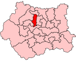
Bradford is a city in West Yorkshire, England. It is governed by a metropolitan borough named after the city, the wider county has devolved powers. It had a population of 349,561 at the 2011 census; the second-largest subdivision of the West Yorkshire Built-up Area after Leeds, which is approximately 9 miles (14 km) to the east. The borough had a population of 546,412, making it the 7th most populous district in England.
Historically part of the West Riding of Yorkshire, the city grew in the 19th century as an international centre of textile manufacture, particularly wool. It was a boomtown of the Industrial Revolution, and amongst the earliest industrialised settlements, rapidly becoming the "wool capital of the world"; this in turn gave rise to the nicknames "Woolopolis" and "Wool City". Lying in the eastern foothills of the Pennines, the area's access to supplies of coal, iron ore and soft water facilitated the growth of a manufacturing base, which, as textile manufacture grew, led to an explosion in population and was a stimulus to civic investment. There is a large amount of listed Victorian architecture in the city including the grand Italianate city hall. It became a municipal borough in 1847, received a city charter in 1897 and, since a 1974 reform, the city limits have been within the current wider borough.
From the mid-20th century, deindustrialisation caused the city's textile sector and industrial base to decline and, since then, it has faced similar economic and social challenges to the rest of post-industrial Northern England, including poverty, unemployment and social unrest. It is the third-largest economy within the Yorkshire and the Humber region at around £10 billion, which is mostly provided by financial and manufacturing industries. It is also a tourist destination, the first UNESCO City of Film and it has the National Science and Media Museum, a city park, the Alhambra theatre and Cartwright Hall. The city is the UK City of Culture for 2025 having won the designation on 31 May 2022.


