Lège-Cap-Ferret
Communes of GirondeGironde geography stubsPages with French IPA

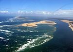
Lège-Cap-Ferret (French pronunciation: [lɛʒ kap fɛʁɛ]; Gascon: Lèja e lo Horet) is a commune in the Gironde department in Nouvelle-Aquitaine in southwestern France. The commune stretches along the length of the Cap Ferret peninsula, from the village of Lège in the north to the point of Cap Ferret in the south.
Excerpt from the Wikipedia article Lège-Cap-Ferret (License: CC BY-SA 3.0, Authors, Images).Lège-Cap-Ferret
Allée de la Clairière, Arcachon
Geographical coordinates (GPS) Address Nearby Places Show on map
Geographical coordinates (GPS)
| Latitude | Longitude |
|---|---|
| N 44.7939 ° | E -1.1453 ° |
Address
Allée de la Clairière 7
33950 Arcachon
Nouvelle-Aquitaine, France
Open on Google Maps


