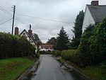
Claverdon

Claverdon is a village and civil parish in the Stratford-on-Avon district of Warwickshire, England, about 5 miles (8.0 km) west of the county town of Warwick. Claverdon's toponym comes from the Old English for "clover hill". The hill is near the centre of the scattered parish which included the township of Langley to the south, and formerly comprised the manors of Claverdon, Langley, Kington (to the south-west), and Songar (in the south-east). There are hamlets near the church and at Yarningale, Kington, Lye Green, and Gannaway; and there is also a group of houses near the school. It includes modern development along with historic buildings: the forge; The Stone Building; St Michael's Church; and 16th and 17th century half-timbered cottages.
Excerpt from the Wikipedia article Claverdon (License: CC BY-SA 3.0, Authors, Images).Claverdon
Church Centre Driveway, Stratford-on-Avon Claverdon CP
Geographical coordinates (GPS) Address Nearby Places Show on map
Geographical coordinates (GPS)
| Latitude | Longitude |
|---|---|
| N 52.2799 ° | E -1.7106 ° |
Address
Church Centre Driveway
Church Centre Driveway
CV35 8HG Stratford-on-Avon, Claverdon CP
England, United Kingdom
Open on Google Maps


