place

Cat Bells

Fells of the Lake District
Cat Bells and Friars Crag

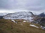
Cat Bells is a fell in the English Lake District in the county of Cumbria. It has a height of 451 metres (1,480 ft) and is one of the most popular fells in the area. It is situated on the western shore of Derwentwater within three miles (five kilometres) of the busy tourist town of Keswick. Its distinctive shape catches the attention of many visitors to the Lakes who feel compelled to climb to the summit after seeing it from the viewpoint of Friars' Crag on the opposite side of Derwentwater. The Lake District writer and walker Alfred Wainwright acknowledges the popularity of Cat Bells among fellwalkers of all abilities by saying:"It is one of the great favourites, a family fell where grandmothers and infants can climb the heights together, a place beloved. Its popularity is well deserved: its shapely topknott attracts the eye offering a steep but obviously simple scramble."

Excerpt from the Wikipedia article Cat Bells (License: CC BY-SA 3.0, Authors, Images).

Geographical coordinates (GPS)

Latitude Longitude
N 54.56865 ° E -3.17083 °
placeShow on map

Address

Mart Bield


CA12 5TU , Above Derwent
England, United Kingdom
mapOpen on Google Maps

Cat Bells and Friars Crag
Share experience

Nearby Places

Derwentwater
Derwentwater

Derwentwater, or Derwent Water, is a lake in the Lake District in North West England, immediately south of Keswick. It is in the unitary authority of Cumberland within the ceremonial county of Cumbria. It is the third largest lake by area, after Windermere and Ullswater. It has a length of 4.6 kilometres (2.9 mi), a maximum width of 1.91 kilometres (1.19 mi), and an area of 5.4 square kilometres (2.1 sq mi). Its primary inflow and outflow is the River Derwent, which also flows through Bassenthwaite Lake before reaching the Irish Sea at Workington. There are several islands within the lake, one of which is inhabited. Derwentwater is a place of considerable scenic value. It is surrounded by hills (known locally as fells), and many of the slopes facing Derwentwater are extensively wooded. A regular passenger launch operates on the lake, taking passengers between various landing stages. There are seven lakeside marinas, the most popular stops being Keswick, Portinscale and the Lodore Falls, from which boats may be hired. Recreational walking is a major tourist activity in the area and there is an extensive network of footpaths in the hills and woods surrounding the lake. The Keswick to Borrowdale road runs along the eastern shore of the lake and carries a regular bus service. There is a lesser, or unclassified, road along the western shore connecting the villages of Grange and Portinscale. Derwentwater gave its name to the Earldom of Derwentwater. From 2008 to 2014, the lake was believed to be the last remaining native habitat of the vendace (Coregonus vandesius) fish from the four originally known sites: Bassenthwaite Lake and Derwentwater in the Lake District, and the Castle Loch & Mill Loch in Lochmaben. However, a breeding population was discovered at Bassenthwaite Lake by conservationists in September 2014. The lake (and many others) is polluted with the invasive New Zealand Pigmyweed.