place

Myrina (Aeolis)

Aeolian dodecapolisAliağa DistrictAncient Greek archaeological sites in TurkeyCatholic titular sees in AsiaCommons category link is locally defined
Former populated places in TurkeyGreek city-statesGreek colonies in MysiaHistory of İzmir ProvinceMembers of the Delian LeaguePopulated places in ancient AeolisRoman towns and cities in Turkey
Erkmen se MarchesAliagaTurkey

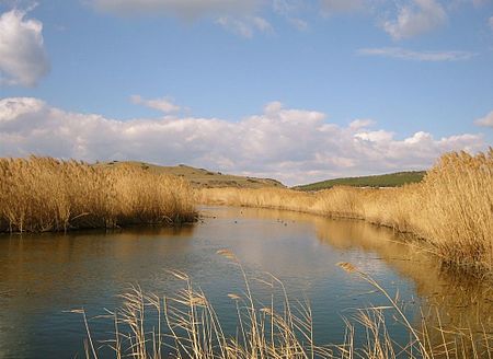
Myrina (Ancient Greek: Μυρίνα) was one of the Aeolian cities on the western coast of Mysia, about 40 stadia to the southwest of Gryneion. The former bishopric is now a Latin Catholic titular see. Its site is believed to be occupied by the modern Sandarlik at the mouth of the Koca Çay, near the town of Aliağa in Izmir Province, in the Aegean Region of Turkey, near Kalavas(ar)i.

Excerpt from the Wikipedia article Myrina (Aeolis) (License: CC BY-SA 3.0, Authors, Images).

Geographical coordinates (GPS)

Latitude Longitude
N 38.845277777778 ° E 26.984444444444 °
placeShow on map

Address


35800
Turkey
mapOpen on Google Maps

Erkmen se MarchesAliagaTurkey
Share experience

Nearby Places

Bakırçay

Bakırçay (Latin: Caicus, Ancient Greek: Κάϊκος) is a river in Turkey. It rises in the Gölcük Dağları mountains and debouches into the Gulf of Çandarlı. In antiquity, the Bakırçay was or formed part of the Kaikos or Caicus River which flowed near the city of Pergamon and was the site of the Battle of the Caecus River. The Kaikos River is mentioned by Hesiod and Plutarch, who claims that its name was originally Astraeus (Ἀστραῖος) but was changed after Caicus, a son of Hermes, threw himself into it after sleeping with his sister Alcippe. However, since the course of the river has changed since antiquity it is not clear how the ancient names apply to the modern geographical features. Leake infers from the direction of L. Scipio's march from Troy to the Hyrcanian plain, that the Caicus was the north-eastern branch of the river of Pergamon which flows by Menduria (possibly Gergitha) and Balıkesir (Caesaraea). The Caicus as it seems is formed by two streams which meet between 50 and 65 km above its mouth, and it drains an extensive and fertile country. Strabo (p. 616) says that the sources of the Caicus are in a plain separated by the range of Temnos from the plain of Apiae, and that the plain of Apia lies above the plain of Thebe in the interior. He adds that there also flows from Tetanus a river (the Mysius) which joins the Caicus below its source. The Caicus enters the sea approximately 12 km from Pitane, and 3 km from Elaea. Elaea was the port of Pergamon, which was on the Caicus, approximately 25 km from Elaea.The Bakırçay is one of the two candidates for the Hittite placename Seha River, site of the Seha River Land known from texts such as the Manapa-Tarhunta letter. The Gediz River is the other candidate.

Gryneium
Gryneium

Gryneium or Gryneum or Gryneion (Ancient Greek: Γρύνειον), also Grynium or Grynion (Γρύνιον), Grynia or Gryneia (Γρύνεια) and Grynoi (Γρῦνοι), was a city of ancient Aeolis. It was located 40 stadia from Myrina and 70 from Elaea. In early times it was independent, one of the 12 important cities of Aeolis, but afterwards became subject to Myrina. It contained a sanctuary of Apollo with an ancient oracle and a splendid temple of white marble. Because of the city Apollo derived the surname of Gryneus. Pausanias wrote that at Gryneium, where there was an amazing grove of Apollo, with cultivated trees, and all those which, although they bear no fruit, are pleasing to smell or look upon.Xenophon mentions Gryneium as belonging to Gongylus of Eretria; and it is possible that the castrum Grunium in Phrygia, from which Alcibiades derived an income of 50 talents was the town of Grynium. It was a member of the Delian League.In 334 BC, Parmenion, who was one of the commanders of Alexander the Great, came to the region before Alexander's invasion took the town by assault, burned it, and sold its inhabitants as slaves, to prevent the resistance of the people around.Its ruins are near Aliağa in İzmir province of Turkey in western Anatolia. It is on the Aegean coast and very close to the modern town of Yeni Şakran. The first excavations were made by the French in 1883 and lasted several days. With a few pieces of vase, bronze objects were found. The next excavation was carried out by the Bergama Museum in 1959. During the expansion of Izmir-Çanakkale highway, a beautiful mosaic and necropolis area was found with sarcophagi. Today there has been no construction in the local area and the ruins can easily be seen from a great distance.