place

Theodore Roosevelt Bridge

1964 establishments in Virginia1964 establishments in Washington, D.C.Bridges completed in 1964Bridges of the United States Numbered Highway SystemBridges on the Interstate Highway System
Bridges over the Potomac RiverBuildings and monuments honoring American presidents in the United StatesBuildings and structures in Arlington County, VirginiaGirder bridges in the United StatesInterstate 66Road bridges in VirginiaRoad bridges in Washington, D.C.Roads with a reversible laneSteel bridges in the United StatesTransportation in Arlington County, VirginiaU.S. Route 50
Theodore Roosevelt Bridge Rossyln

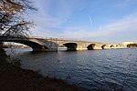
The Theodore Roosevelt Bridge (also known as the Teddy Roosevelt Bridge or the Roosevelt Bridge) is a bridge crossing the Potomac River which connects Washington, D.C., with the Commonwealth of Virginia. The bridge crosses over Theodore Roosevelt Island, and carries Interstate 66/U.S. Route 50. The center lane in the bridge is reversible; the middle barrier is moved with a barrier transfer machine. It's operated eastbound during the morning rush hour from 6-11 am. The bridge is named in honor of Theodore Roosevelt, the 26th President of the United States.

Excerpt from the Wikipedia article Theodore Roosevelt Bridge (License: CC BY-SA 3.0, Authors, Images).

Theodore Roosevelt Bridge
US 50, Washington

Geographical coordinates (GPS) Address External links Nearby Places
placeShow on map

Wikipedia: Theodore Roosevelt BridgeContinue reading on Wikipedia

Geographical coordinates (GPS)

Latitude Longitude
N 38.892222222222 ° E -77.059444444444 °
placeShow on map

Address

Theodore Roosevelt Bridge (Teddy Roosevelt Bridge)

US 50
20566 Washington
District of Columbia, United States
mapOpen on Google Maps

linkWikiData (Q2660680)
linkOpenStreetMap (574911702)

Theodore Roosevelt Bridge Rossyln
Share experience

Nearby Places

Construction of Arlington Memorial Bridge

The construction of Arlington Memorial Bridge was a seven-year construction project in Washington, D.C., in the United States to construct the Arlington Memorial Bridge across the Potomac River. The bridge was authorized by Congress in February 1925, and was completed in January 1932. As a memorial, its decorative features were extensive and intricate, and resolving the design issues over these details took many years. Tall columns and pylons topped by statuary, Greek Revival temple-like structures, and statue groups were proposed for the ends of the bridge. Carvings and inscriptions were planned for the sides of the bridge, and extensive statuary for the bridge piers. The bridge itself took far longer than the anticipated two years. Problems were encountered in building the foundations, accidents occurred, and the construction of the bascule (or drawbridge) span was complex and lengthy. Even though the bridge was finished by January 1932, construction of the termini and completion of the memorial details took another six years. Budget problems created in part by the Great Depression meant that portions of the bridge project were never completed. Construction of the bridge's western terminus involved extensively enlarging an island in the Potomac River, building bridges between this island and the Virginia mainland, building a new ceremonial entrance at Arlington National Cemetery, and creating a memorial drive to connect the cemetery to the bridge. The bridge's eastern approaches were equally as complex, and required construction of a plaza to the west of the Lincoln Memorial, connecting the bridge to the Rock Creek and Potomac Parkway, and building a "watergate" (marble steps) to given the public access to the river. The bridge was added to the National Register of Historic Places in 1980.

Theodore Roosevelt Island

Theodore Roosevelt Island is an 88.5-acre (358,000 m2) island and national memorial located in the Potomac River in Washington, D.C. During the Civil War, it was used as a training camp for the United States Colored Troops. The island was given to the federal government by the Theodore Roosevelt Association in memory of the 26th president, Theodore Roosevelt. Until then, the island had been known as My Lord's Island, Barbadoes Island, Mason's Island, Analostan Island, and Anacostine Island.The island is maintained by the National Park Service, as part of the nearby George Washington Memorial Parkway. The land is generally maintained as a natural park, with various trails and a memorial plaza featuring a statue of Roosevelt. No cars or bicycles are permitted on the island, which is reached by a footbridge from Arlington, Virginia, on the western bank of the Potomac. "In the 1930s landscape architects transformed Mason’s Island from neglected, overgrown farmland into Theodore Roosevelt Island, a memorial to America’s 26th president. They conceived a 'real forest' designed to mimic the natural forest that once covered the island. Today miles of trails through wooded uplands and swampy bottomlands honor the legacy of a great outdoorsman and conservationist."A small island, Little Island, lies just off the southern tip; Georgetown and the John F. Kennedy Center for the Performing Arts are respectively across the main channel of the Potomac to the north and the east.