Theodore Roosevelt Island

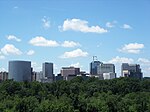
Theodore Roosevelt Island is an 88.5-acre (358,000 m2) island and national memorial located in the Potomac River in Washington, D.C. During the Civil War, it was used as a training camp for the United States Colored Troops. The island was given to the federal government by the Theodore Roosevelt Association in memory of the 26th president, Theodore Roosevelt. Until then, the island had been known as My Lord's Island, Barbadoes Island, Mason's Island, Analostan Island, and Anacostine Island.The island is maintained by the National Park Service, as part of the nearby George Washington Memorial Parkway. The land is generally maintained as a natural park, with various trails and a memorial plaza featuring a statue of Roosevelt. No cars or bicycles are permitted on the island, which is reached by a footbridge from Arlington, Virginia, on the western bank of the Potomac. "In the 1930s landscape architects transformed Mason’s Island from neglected, overgrown farmland into Theodore Roosevelt Island, a memorial to America’s 26th president. They conceived a 'real forest' designed to mimic the natural forest that once covered the island. Today miles of trails through wooded uplands and swampy bottomlands honor the legacy of a great outdoorsman and conservationist."A small island, Little Island, lies just off the southern tip; Georgetown and the John F. Kennedy Center for the Performing Arts are respectively across the main channel of the Potomac to the north and the east.
Excerpt from the Wikipedia article Theodore Roosevelt Island (License: CC BY-SA 3.0, Authors, Images).Theodore Roosevelt Island
Mount Vernon Trail, Washington Rosslyn
Geographical coordinates (GPS) Address Nearby Places Show on map
Geographical coordinates (GPS)
| Latitude | Longitude |
|---|---|
| N 38.897222222222 ° | E -77.064166666667 ° |
Address
Theodore Roosevelt Monument
Mount Vernon Trail
20566 Washington, Rosslyn
District of Columbia, United States
Open on Google Maps


