place

Malmedy massacre

1944 in Belgium1944 murders in BelgiumBattle of the BulgeDecember 1944 eventsMalmedy
Massacres in 1944Massacres in BelgiumPages with empty portal templatePortal templates with redlinked portalsUse American English from October 2020War crimes in BelgiumWar crimes of the Waffen-SSWorld War II prisoner of war massacres by Nazi Germany
Bodies of U.S. officers and soldiers slained by the Nazis after capture near Malmedy, Belgium. NARA 196544

The Malmedy massacre was a German war crime committed by soldiers of the Waffen-SS on 17 December 1944 at the Baugnez crossroads near the city of Malmedy, Belgium, during the Battle of the Bulge (16 December 1944 – 25 January 1945). Soldiers of Kampfgruppe Peiper summarily killed eighty-four U.S. Army prisoners of war (POWs) who had surrendered after a brief battle. The Waffen-SS soldiers had grouped the U.S. POWs in a farmer's field, where they used machine guns to shoot and kill the grouped POWs; the prisoners of war who survived the gunfire of the massacre were killed with a coup de grâce gunshot to the head.Besides the summary execution of the eighty-four U.S. POWs at the farmer's field, the term "Malmedy massacre" also includes other Waffen-SS massacres of civilians and POWs in Belgian villages and towns in the time after their first massacre of U.S. POWs at Malmedy; these Waffen-SS war crimes were the subjects of the Malmedy massacre trial (May–July 1946), which was a part of the Dachau trials (1945–1947).

Excerpt from the Wikipedia article Malmedy massacre (License: CC BY-SA 3.0, Authors, Images).

Malmedy massacre
Route de Waimes,

Geographical coordinates (GPS) Address Nearby Places
placeShow on map

Wikipedia: Malmedy massacreContinue reading on Wikipedia

Geographical coordinates (GPS)

Latitude Longitude
N 50.403888888889 ° E 6.0661944444444 °
placeShow on map

Address

Route de Waimes

Route de Waimes
4960
Liège, Belgium
mapOpen on Google Maps

Bodies of U.S. officers and soldiers slained by the Nazis after capture near Malmedy, Belgium. NARA 196544
Share experience

Nearby Places

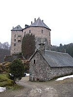
Reinhardstein Castle

Reinhardstein Castle (Walloon: Tchestea di Rénastène; French: Château de Reinhardstein; German: Burg Reinhardstein) is a castle of Wallonia in the village of Ovifat, in the Warche valley of Liège Province, Belgium. The stronghold was built in 1354 for Wenceslaus of Luxembourg, while still Count, by his vassal Reinhard of Weismes. It sits on a rocky outcrop in the river valley and is now surrounded by forest. By inheritance and marriage, it passed successively into the hands of the Nesselrode, Nassau, Schwartzenberg families and finally from 1550 to 1812 the property of the Counts of Metternich, except between 1795 and 1798 when the French revolutionary administration confiscated it. Franz Georg Karl Count of Metternich-Winnenburg-Beilstein sold the family estate in 1812 to a building materials dealer. From 1815 to 1919 the area belonged to Prussia. The Prussian administration immediately halted the demolition and attempted for the first time to protect the monument. After the Treaty of Versailles (1919) it became Belgian territory. In the 19th century it was nearly destroyed by quarrying but in 1969 the castle was thoroughly renovated under the impulse of the new owner Professor Jean Overloop. After the reconstruction, he continued to live there until his death in 1994. His wife and daughter, who inherited the castle after his death, donated it to a non-profit organization. The castle is inhabited but accessible to tourists. There is also a picturesque walking route along the castle.