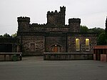
Todmorden

Todmorden ( TOD-mər-dən; locally ) is a market town and civil parish in the Upper Calder Valley in Calderdale, West Yorkshire, England. It is 17 miles (27 kilometres) north-east of Manchester, 8 miles (13 km) south-east of Burnley and 9 miles (14 km) west of Halifax. In 2011, it had a population of 15,481.Todmorden is at the confluence of three steep-sided Pennine valleys and is surrounded by moorlands with outcrops of sandblasted gritstone. The historic boundary between Yorkshire and Lancashire is the River Calder and its tributary, Walsden Water, which run through the town. The administrative border was altered by the Local Government Act 1888 placing the whole of the town within the West Riding. The town is served by Todmorden and Walsden railway stations.
Excerpt from the Wikipedia article Todmorden (License: CC BY-SA 3.0, Authors, Images).Todmorden
Union Street South, Calderdale
Geographical coordinates (GPS) Address Nearby Places Show on map
Geographical coordinates (GPS)
| Latitude | Longitude |
|---|---|
| N 53.713 ° | E -2.096 ° |
Address
Union Street South 12
OL14 5PX Calderdale
England, United Kingdom
Open on Google Maps


