Riddlesden
Geography of the City of BradfordUse British English from April 2019Villages in West Yorkshire

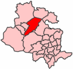
Riddlesden is a suburb of Keighley (historically a separate village) in the county of West Yorkshire, England and on the Leeds and Liverpool Canal.The village lies 1.9 miles (3 km) east of Keighley town centre and is on the B6265 road between Keighley and Bingley. The part of the village by the canal is at a height of 360 feet (110 m) above sea level.
Excerpt from the Wikipedia article Riddlesden (License: CC BY-SA 3.0, Authors, Images).Riddlesden
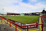
St Mary's Road, Bradford
Geographical coordinates (GPS) Address Nearby Places Show on map
Geographical coordinates (GPS)
| Latitude | Longitude |
|---|---|
| N 53.88 ° | E -1.883 ° |
Address
St Mary's Road
BD20 5PA Bradford
England, United Kingdom
Open on Google Maps


