place

St Leonards, Victoria

Bellarine PeninsulaCoastal towns in Victoria (state)Suburbs of GeelongTowns in Victoria (state)Use Australian English from August 2019
St Leonards Victoria

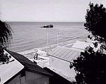
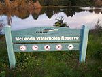
St Leonards is a coastal township near Geelong, Victoria, Australia, at the eastern end of the Bellarine Peninsula and the northern end of Swan Bay. Situated 33 kilometres (21 mi) east of Geelong, St Leonards was a filming location for the Australian television series SeaChange. The town is surrounded by salt marsh wildlife reserves which provide habitat for hundreds of birds, including the critically endangered orange-bellied parrot of which there are less than 200 in the wild. Salt marshes are one of the most biologically productive habitats on the planet, rivalling tropical rainforests. St. Leonards has also just been nominated to have the cleanest beaches in Victoria.St Leonards is positioned centrally to many local wineries and eateries of the Bellarine Peninsula.

Excerpt from the Wikipedia article St Leonards, Victoria (License: CC BY-SA 3.0, Authors, Images).

St Leonards, Victoria
The Esplanade, City of Greater Geelong

Geographical coordinates (GPS) Address Nearby Places
placeShow on map

Wikipedia: St Leonards, VictoriaContinue reading on Wikipedia

Geographical coordinates (GPS)

Latitude Longitude
N -38.166666666667 ° E 144.71666666667 °
placeShow on map

Address

The Esplanade

The Esplanade
3223 City of Greater Geelong, Indented Head
Victoria, Australia
mapOpen on Google Maps

St Leonards Victoria
Share experience

Nearby Places

Port Phillip Bay (Western Shoreline) and Bellarine Peninsula Ramsar Site

The Port Phillip Bay (Western Shoreline) and Bellarine Peninsula Ramsar Site is one of the Australian sites listed under the Ramsar Convention as a wetland of international importance. It was designated on 15 December 1982, and is listed as Ramsar Site No.266. Much of the site is also part of either the Swan Bay and Port Phillip Bay Islands Important Bird Area or the Werribee and Avalon Important Bird Area, identified as such by BirdLife International because of their importance for wetland and waterbirds as well as for orange-bellied parrots. It comprises some six disjunct, largely coastal, areas of land, totalling 229 km2, along the western shore of Port Phillip and on the Bellarine Peninsula, in the state of Victoria. Wetland types protected include shallow marine waters, estuaries, freshwater lakes, seasonal swamps, intertidal mudflats and seagrass beds.The subsites include: Part of Point Cook, including the coastline from Skeleton Creek to the Point Cook Coastal Park Much of the Western Treatment Plant, as well as the adjacent Spit Nature Conservation Reserve and Avalon Airfield A strip of coastline on the north shore of Corio Bay, including Point Wilson, Point Lillias and Limeburners Bay Swan Bay at the eastern end of the Bellarine Peninsula Mud Islands in western Port Phillip The Lake Connewarre wetland complex, including Lake Connewarre, Reedy Lake, Murtnaghurt Lagoon and the Barwon River estuary in the south-western Bellarine Peninsula