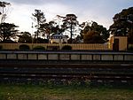
Drysdale, Victoria

Drysdale is a rural township near Geelong, Victoria, Australia, located on the Bellarine Peninsula. The town has an approximate population of over 3,700. Drysdale forms part of an urban area, along with nearby Clifton Springs, that had an estimated population of 13,494 at June 2016. A popular youth music and performing arts venue, affectionately labelled 'The Potato Shed' is located in the back of Drysdale. The industrial size venue is the site of 'Battle of The Bands', a yearly music festival which has seen a number of local bands make a name for themselves in a popular setting. Drysdale has several primary and high schools, including Saint Ignatius College, the senior campus of Bellarine Secondary College, and a campus of Christian College. The local football club is the Drysdale Hawks, who play Australian Rules Football and compete in the Bellarine Football League. The Hawks were formed in 1879 and have won 15 premiership titles, the last in 2010. The Bellarine Rail Trail also runs through the town. The local cricket club is also named the Drysdale Hawks.
Excerpt from the Wikipedia article Drysdale, Victoria (License: CC BY-SA 3.0, Authors, Images).Drysdale, Victoria
Flinders View Drive, City of Greater Geelong
Geographical coordinates (GPS) Address Nearby Places Show on map
Geographical coordinates (GPS)
| Latitude | Longitude |
|---|---|
| N -38.166666666667 ° | E 144.56666666667 ° |
Address
Flinders View Drive
Flinders View Drive
3222 City of Greater Geelong
Victoria, Australia
Open on Google Maps


