place

Birmingham and Fazeley Canal

1789 establishments in EnglandBirmingham Canal NavigationsCanals in StaffordshireCanals in the West Midlands (county)Canals opened in 1789
EngvarB from May 2016Geographic coordinate listsKingsbury, WarwickshireLists of coordinatesTourist attractions in Birmingham, West MidlandsTransport in Birmingham, West Midlands
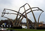
Drayton bridges, Birmingham and Fazeley Canal

The Birmingham and Fazeley Canal is a canal of the Birmingham Canal Navigations in the West Midlands of England. Its purpose was to provide a link between the Coventry Canal and Birmingham and thereby connect Birmingham to London via the Oxford Canal.

Excerpt from the Wikipedia article Birmingham and Fazeley Canal (License: CC BY-SA 3.0, Authors, Images).

Birmingham and Fazeley Canal
Lathe Way, Birmingham Castle Vale

Geographical coordinates (GPS) Address Nearby Places
placeShow on map

Wikipedia: Birmingham and Fazeley CanalContinue reading on Wikipedia

Geographical coordinates (GPS)

Latitude Longitude
N 52.5225 ° E -1.7957 °
placeShow on map

Address

Lathe Way

Lathe Way
B24 0SD Birmingham, Castle Vale
England, United Kingdom
mapOpen on Google Maps

Drayton bridges, Birmingham and Fazeley Canal
Share experience

Nearby Places

Castle Vale
Castle Vale

Castle Vale is a housing estate located between Erdington, Minworth and Castle Bromwich. Currently Castle Vale makes up the Castle Vale Ward of Birmingham City Council which is part of Erdington constituency (having previously been part of Hodge Hill constituency until recent times), 6 miles (9 km) northeast of Birmingham city centre in England. The area has an approximate population of 10,000 people and has a distinctly modern residential character stemming from its history as a postwar overspill estate. The area was originally known as Berwood, from the Saxon 'Bearu' meaning 'the woods'. Historically being a boggy and wooded area, the area remained undeveloped for most of its history until the deforestation practices of Edward Darcy in the 17th century and the construction of the Birmingham and Fazeley Canal in the 18th century. In the 20th century, the land became the site for the first aeroplane take-off in Birmingham which led to a long aviation history being associated with the area. Castle Bromwich Aerodrome was established on the site and operated from 1914 to 1960, being a major airfield in both World Wars and also having industrial importance as the testing facility for locally manufactured aeroplanes and the location for the British Industries Fair. Despite being steeped in aviation history, Castle Vale became infamous from the 1970s onwards as a large scale example of a failed postwar overspill estate, which suffered from poor construction and maintenance, social deprivation and high levels of crime. The area became the focus of a targeted regeneration initiative, led by the Castle Vale Housing Action Trust (CVHAT) from 1993 to 2005, where the estate witnessed the demolition of many of its housing stock and facilities, the refurbishment of remaining properties, and the construction of new housing and facilities along with the remodelling of the estate, funded both privately and publicly.

Pype Hayes Park

Pype Hayes Park is one of the larger parks in Birmingham, England. The park is in Erdington Constituency and straddles the boundary between Pype Hayes and Erdington (now Tyburn ward. It covers B72 and B24. The northern boundary of the park is the traditional boundary between Erdington and Sutton Coldfield. Pype Hayes Park reaches from the corner where Eachelhurst Road joins Chester Road to a point close to Park Close off Chester Road and in places borders Pitts Farm estate. It also leads to Berwood Farm Road and Welwyndale Road. The main park entrance is on Chester Road and by that entrance is the lodge where the head gardener lives, like Pype Hayes Hall this is a grade II listed building. To the left of the main drive to Pype Hayes Hall is a car parking area and further on towards Pype Hayes Hall is a children’s play area with swings and other attractions. Returning to the main drive one can get to the front entrance of Pype Hayes Hall and round there are gardens. The older gardens have a traditional layout with many fairly straight flower beds and dwarf yew hedges. To the north of the traditional garden is a modern garden planted for the millennium. A fountain that was the centrepiece of this garden was vandalised and has been left unrepaired for several years. To the west of the gardens is a fish pond which is also a duck pond with a duck island, many species of water birds can be found there, notably Mallard ducks, Canada geese and frequently a pair of resident mute swan. By the corner where Chester Road meets Eachelhurst Road is the area where the annual bonfire and Funfair are held on 5 November, fairs are also held there at other times of the year. To the north of the section above is mown grass with young trees planted in groups and mature trees, later the land starts to slope downwards to a valley where Plants Brook flows, the brook was culverted during the 1960s due to flooding. Many young trees have been planted in the flattish area round Plants Brook which is near the border of the park. After World War II single-storey prefabricated buildings were built round the park between Chester Road and Eachelhurst Road; each prefab had a small garden to the front and another small garden to the rear. Several decades later these homes were removed, giving a better view of the park and the Manor house but if visitors to the park look closely there is still a level area where the prefabs once stood. During the 1990s there was a problem with travellers who parked caravans without permission, but this was prevented by erecting metal railings round the part of the perimeter of the park where there are no houses, round the car park, along the main driveway, these railings separate areas where vehicles are permitted from areas where vehicles are not permitted. There are gates in these railings which are unlocked for permitted vehicles, for example when the funfair arrives.