place

Wilts & Berks Canal

1810 establishments in EnglandCanals in WiltshireCanals opened in 1810EngvarB from October 2013Geographic coordinate lists
History of BerkshireKennet and Avon CanalLists of coordinatesThames drainage basinTourist attractions in OxfordshireTourist attractions in WiltshireTransport in Oxfordshire
Wilts and Berks Canal Swindon

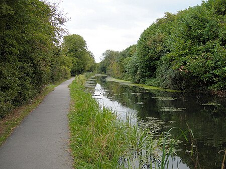
The Wilts & Berks Canal is a canal in the historic counties of Wiltshire and Berkshire, England, linking the Kennet and Avon Canal at Semington near Melksham, to the River Thames at Abingdon. The North Wilts Canal merged with it to become a branch to the Thames and Severn Canal at Latton near Cricklade. Among professional trades boatmen, the canal was nicknamed the Ippey Cut, possibly short for Chippenham. The 52-mile (84 km) canal was opened in 1810, but abandoned in 1914 – a fate hastened by a breach at Stanley aqueduct in 1901. Much of the canal subsequently became unnavigable: many of the structures were deliberately damaged by army demolition exercises; parts of the route were filled in and in some cases built over. In 1977 the Wilts & Berks Canal Amenity Group was formed with a view to full restoration of the canal. Several locks and bridges have since been restored, and over 8 miles (13 km) of the canal have been rewatered.

Excerpt from the Wikipedia article Wilts & Berks Canal (License: CC BY-SA 3.0, Authors, Images).

Wilts & Berks Canal
Peglars Way,

Geographical coordinates (GPS) Address Nearby Places
placeShow on map

Wikipedia: Wilts & Berks CanalContinue reading on Wikipedia

Geographical coordinates (GPS)

Latitude Longitude
N 51.549 ° E -1.805 °
placeShow on map

Address

Peglars Way

Peglars Way
SN1 7DL , Wichelstowe
England, United Kingdom
mapOpen on Google Maps

Wilts and Berks Canal Swindon
Share experience

Nearby Places

Rushey Platt railway station

Rushey Platt railway station is a former station on the Midland and South Western Junction Railway at Rushey Platt, south west of the centre of Swindon in Wiltshire. The line was extended in 1882, and the station opened on 18 December 1883 on the Swindon and Cheltenham Extension Railway line from Swindon Town to the temporary terminus at Cirencester Watermoor. The S&CER line amalgamated in 1884 with the Swindon, Marlborough and Andover Railway to form the M&SWJR, and through services beyond Cirencester to the junction at Andoversford with the Great Western Railway's Cheltenham Lansdown to Banbury line, which had opened in 1881, started in 1891. An additional loop for goods traffic opened in 1921.Rushey Platt was at the junction where the 1883 S&CER line branched off from the SM&AR link line between Swindon Town railway station and the main Great Western Railway station at Swindon. It had platforms on both the through S&CER line and the link, but the service between the two Swindon stations ceased after March 1885 because of the high fees the GWR charged the M&SWJR to run over its tracks, and that part of the station closed only 15 months after it had opened. Passenger services at the through platforms of the station lasted only a further 20 years and were withdrawn in 1905: the station closed on 1 October 1905, the first station on the line to close to passengers. However, the station remained open for goods traffic, mainly milk, until the M&SWJR line closed to goods in 1964, and a private siding lasted even longer. The railway embankment is still visible and all that remains of the station is a very weathered upper platform. The rest of the station has disappeared through time and development, and some of the site has been replaced by part of an industrial warehouse in Swindon's Rushey Platt Industrial Park. The route of the former railway can still be seen with bridges at Mill Lane and Redpost Road.