Strowan

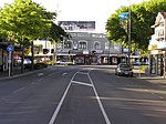
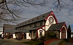
Strowan is an affluent suburb of Christchurch, New Zealand, located approximately 5 km north-west of Christchurch's central business district. It had a population of 3,705 at the 2013 census. It is located between the suburbs of Merivale (South of Leinster Road), Papanui (North-East of Blighs Road), Bryndwr (North-West of Blighs Road, Idris Road (North of Jeffreys Road)), Fendalton (South-West of Idris Road (South of Jeffreys Road)), and St Albans (East of Papanui Road). The area is predominantly residential, containing mostly parks and schools and few retail or commercial buildings. A small shopping centre exists at the intersection of Wairakei and Normans Roads, in the centre of the suburb. There is a private hospital located in the south-eastern corner of Strowan near the border of Merivale, called St. George's Hospital. The main train line north of Christchurch runs through the western part of the suburb - crossings exist on Blighs, Wairakei and Glandovey Roads.Most of the suburb's housing is large and expensive, with a generally older architecture than many newer areas of Christchurch. There was little earthquake damage in Strowan after the 2011 Christchurch earthquake. St George's Hospital, opened in 1928 and now one of New Zealand's largest private hospitals, is at 249 Papanui Road.
Excerpt from the Wikipedia article Strowan (License: CC BY-SA 3.0, Authors, Images).Strowan
Hartley Avenue, Christchurch Strowan
Geographical coordinates (GPS) Address Nearby Places Show on map
 Continue reading on Wikipedia
 Geographical coordinates (GPS)
| Latitude | Longitude |
|---|---|
| N -43.508333333333 ° | E 172.60972222222 ° |
Address
Hartley Avenue 11
8140 Christchurch, Strowan
Canterbury, New Zealand
Open on Google Maps