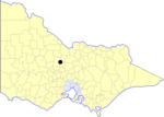
Borough of Eaglehawk
1862 establishments in AustraliaBendigoFormer local government areas of Victoria (state)Incomplete lists from May 2012Populated places established in 1862 ... and 1 more
Use Australian English from August 2019

The Borough of Eaglehawk was a local government area which covered the northwestern suburbs of the regional city of Bendigo, Victoria, Australia. The borough covered an area of 14.54 square kilometres (5.6 sq mi), and existed from 1862 until 1994.
Excerpt from the Wikipedia article Borough of Eaglehawk (License: CC BY-SA 3.0, Authors, Images).Borough of Eaglehawk
Staley Street, Bendigo California Gully (California Gully)
Geographical coordinates (GPS) Address Nearby Places Show on map
Geographical coordinates (GPS)
| Latitude | Longitude |
|---|---|
| N -36.733333333333 ° | E 144.25 ° |
Address
California Gully Primary School
Staley Street 4-14
3550 Bendigo, California Gully (California Gully)
Victoria, Australia
Open on Google Maps


