Woodhouse, South Yorkshire
Use British English from January 2019Wards of Sheffield
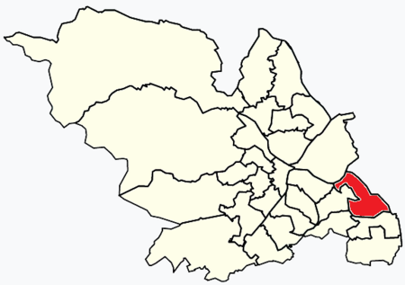
Woodhouse ward—which includes the district of Woodhouse and most of Handsworth—is one of the 28 electoral wards in the City of Sheffield, England. It is located in the southeastern part of the city and covers an area of 2.7 square miles (7.0 km2). The population of this ward in 2011 was 17,450 people in 7,764 households. It is one of the wards that make up the Sheffield South East constituency (formerly Sheffield Attercliffe constituency).
Excerpt from the Wikipedia article Woodhouse, South Yorkshire (License: CC BY-SA 3.0, Authors, Images).Woodhouse, South Yorkshire
Skelton Lane, Sheffield Woodhouse
Geographical coordinates (GPS) Address Nearby Places Show on map
Geographical coordinates (GPS)
| Latitude | Longitude |
|---|---|
| N 53.358 ° | E -1.373 ° |
Address
Skelton Lane
Skelton Lane
S13 7JY Sheffield, Woodhouse
England, United Kingdom
Open on Google Maps

