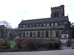
Beeston Urban District
Beeston was an urban district in Nottinghamshire, England, from 1894 to 1935. The urban district was created by the Local Government Act 1894 on the borders of the Beeston Civil Parish and the Beeston Urban Sanitary District. It bordered the county borough of Nottingham in the north east, Stapleford Rural District in the north west, two different disconnected parts of the Basford Rural District to the north and south, and to the west the South East Derbyshire Rural District and Long Eaton in Derbyshire. In 1935 it was merged by a County Review Order with Stapleford Rural District into the Beeston and Stapleford Urban District, and is now part of Broxtowe Borough Council.
Excerpt from the Wikipedia article Beeston Urban District (License: CC BY-SA 3.0, Authors).Beeston Urban District
Hetley Road, Nottingham
Geographical coordinates (GPS) Address Nearby Places Show on map
Geographical coordinates (GPS)
| Latitude | Longitude |
|---|---|
| N 52.933333333333 ° | E -1.2166666666667 ° |
Address
Hetley Road 12
NG9 2QL Nottingham
England, United Kingdom
Open on Google Maps


