Southrepps
Civil parishes in NorfolkLocal Nature Reserves in NorfolkNorth NorfolkSites of Special Scientific Interest in NorfolkUse British English from November 2013 ... and 1 more
Villages in Norfolk

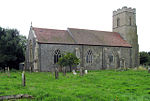
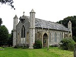
Southrepps is a village and a civil parish in the English county of Norfolk. The village is 5.2 miles (8.4 km) southeast of Cromer, 21.9 miles (35.2 km) north of Norwich and 136.0 miles (218.9 km) north of London. The village lies northeast of the A149 between Kings Lynn and Great Yarmouth. The nearest railway station is at Gunton for the Bittern Line which runs between Sheringham, Cromer and Norwich. The nearest airport is Norwich International Airport. The village is close to the sea and surrounded by rich agricultural land.
Excerpt from the Wikipedia article Southrepps (License: CC BY-SA 3.0, Authors, Images).Southrepps
Long Lane, North Norfolk
Geographical coordinates (GPS) Address Nearby Places Show on map
Geographical coordinates (GPS)
| Latitude | Longitude |
|---|---|
| N 52.87 ° | E 1.35 ° |
Address
Long Lane
Long Lane
NR11 8UT North Norfolk
England, United Kingdom
Open on Google Maps


