Whalley Range, Manchester
Areas of ManchesterManchester City Council Wards
Whalley Range is an area of Manchester, England, about 2 miles (3.2 km) southwest of the city centre. The population at the 2011 census was 15,430. Historically in Lancashire, it was one of the earliest of the city's suburbs, built by local businessman Samuel Brooks.
Excerpt from the Wikipedia article Whalley Range, Manchester (License: CC BY-SA 3.0, Authors).Whalley Range, Manchester
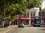
Stanley Road, Manchester Whalley Range
Geographical coordinates (GPS) Address Nearby Places Show on map
Geographical coordinates (GPS)
| Latitude | Longitude |
|---|---|
| N 53.45 ° | E -2.253 ° |
Address
Stanley House
Stanley Road
M16 8HS Manchester, Whalley Range
England, United Kingdom
Open on Google Maps


