Rantiya
Arab villages depopulated during the 1948 Arab–Israeli WarDistrict of JaffaPages with non-numeric formatnum arguments

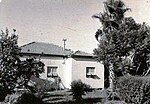
Rantiya (Arabic: رنتيّة, known to the Romans as Rantia and to the Crusaders as Rentie) was a Palestinian village, located 16 kilometers east of Jaffa. During the British Mandate in Palestine, in 1945 it had a population of 590 inhabitants. Those inhabitants became refugees after a 10 July 1948 assault by Israeli forces from the Palmach's Eighth Armored Brigade and the Third Infantry Battalion of the Alexandroni Brigade during the 1948 Arab-Israeli war.Of the over 100 houses that made up the village, only three remain standing today. The Jewish localities of Mazor, Nofekh, and Rinatia are located on Rantiya's former lands.
Excerpt from the Wikipedia article Rantiya (License: CC BY-SA 3.0, Authors, Images).Rantiya
Odem, Hevel Modiin Regional Council
Geographical coordinates (GPS) Address Nearby Places Show on map
Geographical coordinates (GPS)
| Latitude | Longitude |
|---|---|
| N 32.044444444444 ° | E 34.921388888889 ° |
Address
אודם
Odem
4973353 Hevel Modiin Regional Council
Center District, Israel
Open on Google Maps


