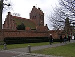
Herlev Municipality

Herlev Kommune is a suburban municipality (Danish, kommune) in Region Hovedstaden on the island of Zealand (Sjælland) in eastern Denmark. The municipality covers an area of 12 km², and has a total population of 29,215 (1. January 2023). Its mayor is Thomas Gyldal Petersen, a member of the Social Democrats (Socialdemokraterne) political party. The former village Herlev is the largest settlement of the municipal and the site of the municipal council. Neighboring municipalities are Gladsaxe to the east and northeast, Furesø Municipality to the north, Ballerup to the west, Glostrup to the southwest, Rødovre to the south, and Copenhagen to the southeast. Herlev municipality was not merged with other municipalities on 1 January 2007 as part of nationwide Kommunalreformen ("The Municipal Reform" of 2007).
Excerpt from the Wikipedia article Herlev Municipality (License: CC BY-SA 3.0, Authors, Images).Herlev Municipality
Højbjergvej, Herlev Municipality
Geographical coordinates (GPS) Address Nearby Places Show on map
Geographical coordinates (GPS)
| Latitude | Longitude |
|---|---|
| N 55.726 ° | E 12.434 ° |
Address
Højbjergvej
2730 Herlev Municipality
Capital Region of Denmark, Denmark
Open on Google Maps


