place

South Fork American River
American River (California)Rivers of El Dorado County, CaliforniaRivers of Northern CaliforniaTributaries of the Sacramento River
Gorilla Pond
Gorilla Pond

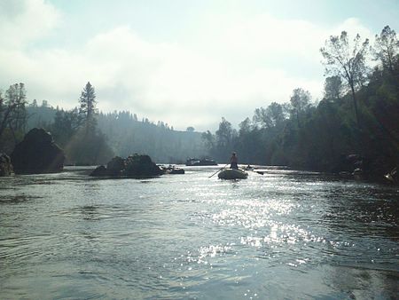
The South Fork American River is a major tributary of the American River in El Dorado County, California, draining a watershed on the western slope of the Sierra Nevada east of Sacramento. The river begins in pristine Desolation Wilderness and flows through the Sierra Nevada foothills. The river at Coloma was the site of James Marshall's discovery of gold at Sutter's Mill on January 24, 1848, which started the California Gold Rush. The South Fork of the American is "the most popular recreation stream in the West" for whitewater rafting in North America, e.g., 80,000 visitors in 2011. Professional whitewater rafting companies have been offering commercial rafting trips on the South Fork American River since 1978.

Excerpt from the Wikipedia article South Fork American River (License: CC BY-SA 3.0, Authors, Images).

South Fork American River
Browns Ravine Trail,

Geographical coordinates (GPS) Address Nearby Places
placeShow on map

Wikipedia: South Fork American RiverContinue reading on Wikipedia

Geographical coordinates (GPS)

Latitude Longitude
N 38.734166666667 ° E -121.10416666667 °
placeShow on map

Address

Browns Ravine Trail

Browns Ravine Trail
95762
California, United States
mapOpen on Google Maps

Gorilla Pond
Gorilla Pond
Share experience

Nearby Places

North Fork American River

The North Fork American River is the longest branch of the American River in Northern California. It is 88 miles (142 km) long from its source at the crest of the Sierra Nevada, near Lake Tahoe, to its mouth at Folsom Lake northeast of Sacramento. Prior to the construction of Folsom Dam the river was about 9 miles (14 km) longer making for a total length of 97 miles (156 km). It rises at Mountain Meadow Lake near the 9,008 ft (2,746 m) peak of Granite Chief in the Tahoe National Forest. Flowing initially northwest, the river soon swings west into a gorge, paralleling the Forest Hill Divide on the south. Big Granite Creek then joins the North Fork of the American River coming in from the right. The canyon shallows as the river turns southwest, carving through the Sierra foothills, then turning abruptly south near Colfax. About 4 miles (6.4 km) downstream, it receives Shirttail Creek from the left then is impounded in Lake Clementine (or North Fork Lake) which is formed by the North Fork Dam, built in 1939 to contain hydraulic mining debris.Below the dam, the river bends south, passing under the Foresthill Bridge, the highest bridge in California, then receives the Middle Fork American River, its largest tributary, from the left. The valley widens as the river flows south past Auburn, soon emptying into the north arm of Folsom Lake, a reservoir formed in 1955 by the Folsom Dam. Its waters merge in the lake with those of the South Fork American River and form the American River, a tributary of the Sacramento River.