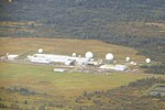
Gloucester-Southgate Ward

Gloucester-Southgate Ward (Ward 10) is a city ward located in Ottawa, Ontario. Located in the city's south end, the ward includes Gloucester Glen east of the Rideau River, most of the Ottawa International Airport, CFSU Uplands, Blossom Park, Greenboro, Hunt Club Park, portions of Heron Gate south of Walkley Road, the Ottawa South/Hawthorne Industrial Park and rural areas west of Anderson Road and north of Leitrim. Previously, the ward included the community of Riverside South located south of the airport but in a ward reorganization, the growing community was included in the new ward of Gloucester-South Nepean. Prior to amalgamation, this area was covered by Southgate Ward on Ottawa City Council and Gloucester South Ward on Gloucester City Council. Southgate Ward was known as Billings Ward from 1980 to 1994, and Gloucester Ward prior to that. The ward was created in 1950, when the area was annexed from Gloucester Township. From 1952 to 1956 it was part of Ward 1.
Excerpt from the Wikipedia article Gloucester-Southgate Ward (License: CC BY-SA 3.0, Authors, Images).Gloucester-Southgate Ward
Queensdale Avenue, Ottawa Gloucester
Geographical coordinates (GPS) Address Nearby Places Show on map
Geographical coordinates (GPS)
| Latitude | Longitude |
|---|---|
| N 45.35 ° | E -75.616666666667 ° |
Address
Queensdale Avenue 1886
K1T 1K6 Ottawa, Gloucester
Ontario, Canada
Open on Google Maps


