place

Skiffe's Creek

Bodies of water of Newport News, VirginiaRivers of James City County, VirginiaRivers of VirginiaTributaries of the James River
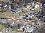
Skiffe's Creek Reservoir at border of James City County and Newport News, Virginia

Skiffe's Creek is located in James City County and the independent city of Newport News in the Virginia Peninsula area of the Hampton Roads region of southeastern Virginia in the United States. It is a tributary of the James River.

Excerpt from the Wikipedia article Skiffe's Creek (License: CC BY-SA 3.0, Authors, Images).

Skiffe's Creek
Warwick Boulevard,

Geographical coordinates (GPS) Address Nearby Places
placeShow on map

Wikipedia: Skiffe's CreekContinue reading on Wikipedia

Geographical coordinates (GPS)

Latitude Longitude
N 37.2075 ° E -76.591111111111 °
placeShow on map

Address

Warwick Boulevard 17667
23603 , Lee Hall
Virginia, United States
mapOpen on Google Maps

Skiffe's Creek Reservoir at border of James City County and Newport News, Virginia
Share experience

Nearby Places

Carter's Grove
Carter's Grove

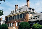
Carter's Grove, also known as Carter's Grove Plantation, is a 750-acre (300 ha) plantation located on the north shore of the James River in the Grove Community of southeastern James City County in the Virginia Peninsula area of the Hampton Roads region of Virginia in the United States. The plantation was built for Carter Burwell, grandson of Robert "King" Carter, and was completed in 1755. It was probably named for both the prominent and wealthy Carter family and nearby Grove Creek. Carter's Grove Plantation was built on the site of an earlier tract known as Martin's Hundred which had first been settled by the English colonists around 1620. In 1976, an archaeological project discovered the site of Wolstenholme Towne, a small settlement downstream a few miles from Jamestown which had been developed in the first 15 years of the Colony of Virginia. The population of the settlement was decimated during the Indian Massacre of 1622.After hundreds of years of multiple owners and generations of families, and the death of the last resident in 1964, Carter's Grove was added to Colonial Williamsburg Foundation's (CW) properties through a gift from the Rockefeller Foundation in 1969. Carter's Grove was open to tourists for many years but closed its doors to the public in 2003 while CW redefined its mission and role. Later that year, Hurricane Isabel seriously damaged Carter's Grove Country Road, which had linked the estate directly to the Historic Area, a distance of 8 miles (13 km), bypassing commercial and public roadways. CW then shifted some of the interpretive programs to locations closer to the main Williamsburg Historic Area and announced in late 2006 that it would be offered for sale under specific restrictive conditions, including a conservation easement. In December 2007, CNET founder Halsey Minor acquired the Georgian style mansion and 476 acres (193 ha) for $15.3 million (~$20.9 million in 2022) and announced plans to use it as his home and for a thoroughbred horse breeding program with the Phipps family. The Virginia Outdoors Foundation and the Virginia Department of Historic Resources co-hold the conservation easement on 400 of the 476 acres. However, Minor never lived at the property and filed for personal bankruptcy in 2013. The Colonial Williamsburg Foundation submitted the only bid at the auction held on May 21, 2014, for the outstanding mortgage amount, and announced that it planned to resell it, with a price increased because of significant costs related to the sale, including over $600,000 (~$734,135 in 2022) in necessary repairs. Samuel M. Mencoff, a founder of Madison Dearborn Partners, acquired the property later in 2014.

Kiskiack (Lee House)

Kiskiack (Lee House) is the name of an early 17th-century brick building, originally built as a private residence, which still stands at the Naval Weapons Station Yorktown in York County, Virginia. This brick structure, the oldest building owned by the U.S. Navy, is listed on the National Register of Historic Places. It was named for the historic Kiskiack, an Algonquian-speaking tribe of the Powhatan Confederacy, who occupied this area at the time of English colonization. It is one-and-a-half stories, built with a gable roof at a relatively steep pitch of 55 degrees. All four walls were laid in Flemish bond, with English bond below the glazed water table. It has a central passage plan and the entrance facade on the west is symmetrical, with a central doorway. Due to a fire in 1915, much of the interior was destroyed but the house is structurally preserved.The house was built on property acquired in 1641 by English immigrant colonist Dr. Henry Harry Lee, who added to his property in 1650 and 1653. He served as a justice of the court of York County in 1646 and was elected to the House of Burgesses in 1656. He married Marah Adkins Fulgate. (Lee's descendants spelled the name of the property as "Kiskiak.") Marah's father was the minister who officiated at the 17th-century marriage of Pocahontas, the Powhatan's daughter, and English colonist John Rolfe. While not definitive, more current genealogical review suggests that Dr. Henry Lee (1597–1657) (Thomas Leigh3, Thomas2, Humphrey1), and Col. Richard Henry Lee (1618–1664) (John4, Richard3, Johannes2, Humphrey1), were possibly 2nd cousins once removed, with Richard's father, John Lee/Lye II, being Dr. Lee's 2nd cousin. A close relationship between the two men is indicated from a 1915 article titled "The Lee Family York County, Virginia": Mr. Henry Lee sat on the same bench with Mr. Richard Lee. Mr. Richard Lee was a burgess for York Co. in 1647, and Mr. Henry Lee was Burgess in 1652. While this close connection might suggest close relationship, there is still other evidence. Richard Lee was surety for Henry Lee in a bond recorded Sept. 25, 1646, to indemnify Mrs. Sibella Felgate (stepmother of Marah Buck Adkins Felgate Lee), widow of Capt. Robert Felgate, decd., for turning over to Henry Lee nine cattle belonging to John Adkins. The bond explains that those cattle were formerly in the custody of Capt. Robert Felgate, who married the mother of the said John Adkins, brother of Marah, the wife of the above named Henry Lee. Felgate's Creek received its name from Captain Robert Felgate, who, with his brother, Tobias Felgate, a well known ship captain, patented land now known as "Ringfield," in the neck made by Felgate's Creek and King's Creek as they enter York River. It is also to be noticed that the bond of Henry and Richard Lee above mentioned was witnessed by William Lee, who was a physician and merchant in York County. Witness William Lee may have been Henry's brother. It is not known if Lee or one of his descendants built the house; it is in the style of the late 17th century and could have been built by his son or grandson. It is described as "a rare survival of a typical early Virginia country house. The quality of both its design and construction is a testament to the high standards of craftsmanship attained by Virginians during the first century of settlement." The T-shaped chimney stacks were assessed as the most significant architectural feature of the house. A small Lee family cemetery is nearby.The Lee family owned the property until 1918, when it and adjoining lands were acquired by the federal government for the Naval Mine Depot. This installation what ultimately developed as Naval Weapons Station Yorktown and is off-limits to the general public. Years later, Barbara Blunt Brooks of Richmond, Virginia donated one of Dr. Lee's hand-crafted tables to the Naval Weapons Museum. This table is one of two identical tables known to have been made by Lee; the location of the other is unknown.The house was photographed and measured for the HABS, and numerous photos are available.(See link below). It is listed on the National Register of Historic Places and the Virginia Landmarks Register.

Grove, Virginia
Grove, Virginia

Grove is an unincorporated community in the southeastern portion of James City County in the Virginia Peninsula subregion of Virginia in the United States. It is located in the center of the Historic Triangle of Colonial Virginia, communities linked by the Colonial Parkway. This area is one of the busiest tourist destinations in the world. Grove is located about 7 miles (11 km) east of Williamsburg along U.S. Route 60. Grove is bordered by the James River and separated from the Newport News city limits near Lee Hall by Skiffe's Creek. Historic places in Grove related to Virginia colonial past include the archaeological site of Wolstenholme Towne, the administrative center of Martin's Hundred. It was rediscovered in 1976 on the grounds of Carter's Grove Plantation, built in 1755. The plantation was occupied by private owners through the 1960s. It was owned and operated by the Colonial Williamsburg Foundation and open to the public from the 1970s until 2003. In 2007 the property was sold back into private ownership. Grove's contemporary development began with African-American settlement by freedmen from Carter's Grove and other plantations following the American Civil War. Its population was fewer than 100 people until after the turn of the twentieth century. During the two World Wars, Grove increased markedly in population. In part this was due to attracting hundreds of displaced people, mostly African American, who were uprooted by federal land acquisition for major waterfront military installations in nearby James City and York counties. Navy bases established were the Naval Weapons Station Yorktown, the Cheatham Annex supply complex, and Camp Peary. As of early 2008, many new homes were under construction in Grove. Along the southeastern edge, available sites and frontage on the James River and Skiffe's Creek are zoned for industrial purposes. These have been attractive to developers of new and expanded businesses.