Hoole Village
Cheshire West and ChesterCheshire geography stubsFormer civil parishes in CheshireUse British English from April 2021

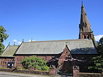
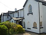
Hoole Village is a village and former civil parish near Chester, in the unitary authority of Cheshire West and Chester and the ceremonial county of Cheshire, England. The civil parish was abolished in 2015 to form Mickle Trafford and District, part of it also went to Guilden Sutton. The parish contained the southern end of the M53 motorway where it becomes the A55 road and is crossed by the A56 road. This junction is known as Hoole Island Junction. Also in the village is Hoole Hall, which is now a hotel.In 2004 the population was 230, rising to 319 at the time of the 2011 census.
Excerpt from the Wikipedia article Hoole Village (License: CC BY-SA 3.0, Authors, Images).Hoole Village
Guilden Sutton Lane, Chester Mickle Trafford and District
Geographical coordinates (GPS) Address Nearby Places Show on map
Geographical coordinates (GPS)
| Latitude | Longitude |
|---|---|
| N 53.207 ° | E -2.85 ° |
Address
Pipers Ash, Guilden Sutton Lane / Moorcroft Crescent
Guilden Sutton Lane
CH3 7EY Chester, Mickle Trafford and District
England, United Kingdom
Open on Google Maps


