place

Drypool

Geographic coordinate listsGeographic histories of Kingston upon HullLists of coordinatesUse British English from September 2013Wards and districts of Kingston upon Hull
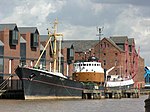
Victoria Dock housing geograph.org.uk 808074

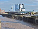
Drypool (archaic Dripole) is an area within the city of Kingston upon Hull, England. Historically Drypool was a village, manor and later parish on the east bank of the River Hull near the confluence of the Humber Estuary and River Hull; it is now part of the greater urban area of Kingston upon Hull, and gives its name to a local government ward. Modern Drypool ward is a mixture of light industrial developments and housing, mainly terraced, as well as the post 1980s housing development 'Victoria Dock Village' built on the infilled site of the former Victoria Dock. The area also includes 'The Deep' aquarium, several schools, and a swimming baths.

Excerpt from the Wikipedia article Drypool (License: CC BY-SA 3.0, Authors, Images).

Drypool
Great Union Street, Hull Drypool

Geographical coordinates (GPS) Address Nearby Places
placeShow on map

Wikipedia: DrypoolContinue reading on Wikipedia

Geographical coordinates (GPS)

Latitude Longitude
N 53.74467 ° E -0.32471 °
placeShow on map

Address

Great Union Street

Great Union Street
HU9 1UB Hull, Drypool
England, United Kingdom
mapOpen on Google Maps

Victoria Dock housing geograph.org.uk 808074
Share experience

Nearby Places

Hull Castle
Hull Castle

Hull Castle was an artillery fort in Kingston upon Hull in England. Together with two supporting blockhouses, it defended the eastern side of the River Hull, and was constructed by King Henry VIII to protect against attack from France as part of his Device programme in 1542. The castle had two large, curved bastions and a rectangular keep at its centre; the blockhouses to the north and south had three curved bastions supporting guns, and a curtain wall and moat linked the blockhouses and castle. The construction project used material from recently dissolved monasteries, and cost £21,056. The town took over responsibility for these defences in 1553, leading to a long running dispute with the Crown as to whether the civic authorities were fulfilling their responsibilities to maintain them. During the 16th and 17th centuries, the defences were used to imprison Catholic recusants, who were often held in harsh conditions. The castle and blockhouses saw service during the sieges of the English Civil War in the 1640s, and remained in used during the interregnum. After the restoration of Charles II, the buildings were neglected until the King redeveloped the eastern defences of Hull in 1681, creating a larger fortification called the Citadel. The castle and the South Blockhouse formed part of the new design, although the North Blockhouse was allowed to fall into ruins and finally demolished in 1801. The former buildings remained in use, with various modifications, until the Citadel was demolished in 1864 to allow the construction of new docks. The foundations survived and have been the subject of archaeological investigations.