place

Fallowfield, Ottawa

BSL3 laboratories in CanadaNeighbourhoods in OttawaUse Canadian English from January 2023

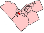
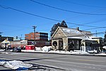
Fallowfield is an unincorporated village (also known as Fallowfield Village) in the city of Ottawa, Ontario, Canada, located south-west of Bells Corners, west of Barrhaven and the 416 and north-east of Richmond within the southwest area of the city. Fallowfield is located in the triangle of Fallowfield Road, Richmond Road and Steeple Hill Crescent and also includes Richmond Road north up to Hope Side Road. The village serves as a bedroom community for the larger urban area of Ottawa as there are no retail or commercial enterprises in the village. It assumes a rather prominent position over the surrounding countryside as the major part of the village is located on a gently terraced escarpment. Population for the village is estimated at about 366 people as of 2004. Public high school students in this area go to South Carleton High School in Richmond. It is the site of the CFIA Fallowfield Laboratory, a 2000-acre farm which houses amongst other facilities the Food Science Laboratory, the Ottawa Animal Health Laboratory, and the Ottawa Plant Laboratory.

Excerpt from the Wikipedia article Fallowfield, Ottawa (License: CC BY-SA 3.0, Authors).

Fallowfield, Ottawa
Old Richmond Road, Ottawa Nepean

Geographical coordinates (GPS) Address Nearby Places
placeShow on map

Wikipedia: Fallowfield, OttawaContinue reading on Wikipedia

Geographical coordinates (GPS)

Latitude Longitude
N 45.2675 ° E -75.829722222222 °
placeShow on map

Address

Old Richmond Road

Old Richmond Road
K2M 2Z2 Ottawa, Nepean
Ontario, Canada
mapOpen on Google Maps

Share experience

Nearby Places

Cedarhill Estate

Cedarhill Estates (also spelled Cedar Hill) is an neighbourhood located in Barrhaven Ward in the west end of Ottawa. Prior to amalgamation in 2001, it was located in Nepean. Together with Orchard Estates and the Onassa Springs development, it is located within the western part of the Ottawa Greenbelt. It is bordered by Fallowfield Road to the south, Cedarview Road to the east, and by Highway 416 to the north and west. It is located northwest of the Barrhaven suburb of the city. The neighbourhood surrounds the Cedarhill Golf Course. The neighbourhood by two nearby interchanges via Highway 416. It is a community comprising approximately 100 custom homes built on 1-acre (4,000 m2) lots. They are serviced by city water and streets, but there are no septic sewers. Each property has its own septic system. The properties are zoned country estate lots and the community does not have bus service, sidewalks, or other features of densely populated urban areas. The neighbourhood was established in 1979. The Cedarhill Community Association is supported by its residents through voluntary fundraising. Typically, over 80 percent of the community contribute on an annual basis. Community funds are used mainly to grow flowers and plants in community flower beds and to keep the common areas trimmed and weed free. Nearby schools include St. Patrick, Barrhaven Public, Cedarview, Knoxdale, Mary Honeywell and Greenbank. Nearby high schools are St. Joseph, Sir Robert Borden, John McRae and Mother Teresa.