place

Mukilteo, Washington

1858 establishments in Washington TerritoryCities in Snohomish County, WashingtonCities in Washington (state)Cities in the Seattle metropolitan areaMukilteo, Washington
Pages with Lushootseed IPAPages with non-numeric formatnum argumentsPopulated places established in 1858Use mdy dates from March 2019Washington placenames of Native American origin
USS Nimitz arrives at homeport. (11422215434)

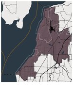
Mukilteo ( MUK-əl-TEE-oh; Lushootseed: bək̓ʷəɬtiwʔ) is a city in Snohomish County, Washington, United States. It is located on Puget Sound between Edmonds and Everett, approximately 25 miles (40 km) north of Seattle. The city had a population of 20,254 at the 2010 census and an estimated 2019 population of 21,441. The current site of downtown Mukilteo (also named Old Town) has been inhabited by the Snohomish people for at least 1,000 years before present. The Treaty of Point Elliott was signed in Mukilteo in 1855, opening the region to American settlement. A new town was founded at Mukilteo and served as the provisional county seat of Snohomish County in early 1861. The area remained a trading post for loggers and was home to other industries, but was overshadowed by Everett and grew slowly. Mukilteo was used during World War II as an auxiliary fueling facility, due to its proximity to the newly built Snohomish County Airport (now Paine Field). Mukilteo was incorporated as a city in 1947 and saw new suburban development, which accelerated after the opening of the nearby Boeing Everett Factory in the late 1960s. The city annexed large suburban areas on the west side of Paine Field in the 1980s and 1990s, including Harbour Pointe and the State Route 525 corridor, while also revitalizing the Old Town area in the 2000s. Today, Mukilteo is a bedroom community with a small job base centered around manufacturing industries. It is also a major transportation hub, with connections to Whidbey Island via the Washington State Ferries system, Sounder commuter trains to Seattle, and public transit services to nearby cities. The city is recognized for its quality of life and is one of the most affluent in Washington state, with a high median income.

Excerpt from the Wikipedia article Mukilteo, Washington (License: CC BY-SA 3.0, Authors, Images).

Mukilteo, Washington
50th Place West,

Geographical coordinates (GPS) Address Nearby Places
placeShow on map

Wikipedia: Mukilteo, WashingtonContinue reading on Wikipedia

Geographical coordinates (GPS)

Latitude Longitude
N 47.916111111111 ° E -122.30305555556 °
placeShow on map

Address

50th Place West 9027
98275
Washington, United States
mapOpen on Google Maps

USS Nimitz arrives at homeport. (11422215434)
Share experience

Nearby Places

Paine Field
Paine Field

Seattle Paine Field International Airport (IATA: PAE, ICAO: KPAE, FAA LID: PAE), also known as Paine Field and Snohomish County Airport, is a commercial and general aviation airport serving the Seattle metropolitan area in the U.S. state of Washington. It is located in unincorporated Snohomish County, Washington, between the cities of Mukilteo and Everett, about 25 miles (40 km) north of Seattle. PAE covers 1,315 acres (2.05 sq mi; 5.32 km2) of land.The airport was built in 1936 by the Works Progress Administration and began commercial service in 1939. It was named for Topliff Olin Paine in 1941, shortly before the Army Air Corps began the occupation of Paine Field for military use. The airport briefly returned to civilian use in the late 1940s, before conversion into an air force base during the Korean War. In 1966, the Boeing Company selected Paine Field for the site of its Everett assembly plant as part of the Boeing 747 program. By the 1970s, the airport had grown into a hub for light aviation and manufacturing, lacking commercial service. The county government sought to begin commercial service at Paine Field as early as the 1980s but was halted by opposition from neighboring cities.In March 2019, Paine Field resumed commercial service at a newly constructed terminal. The Federal Aviation Administration (FAA) National Plan of Integrated Airport Systems for 2023–2027 categorized it as a non-hub primary commercial service facility.

Mukilteo Lighthouse Park

Mukilteo Lighthouse Park encompasses the lighthouse at the west end of the city of Mukilteo, Washington, and 12 acres (0.049 km2) south of it. The property is west and south of the Washington State Ferries terminal with ferry service to Clinton, Whidbey Island, and is bordered on the south and east by the BNSF Railway (formerly the Burlington Northern Railroad) mainline. Whidbey Island lies across a narrow portion of Possession Sound and is easily visible from the shore. This park was formerly known as Mukilteo State Park. The lighthouse was deeded to the City of Mukilteo in 2001, and Washington State Parks deeded the parklands to the City in 2003. In 2004, the City adopted a Lighthouse Park Master Plan to make physical site improvements in four phases. Phases I and II have been completed, adding amenities and parking. The artwork by Joe Gobin and James Madison, Tulalip Tribal carvers, indicates the significance of this site to many tribes, especially the Tulalip Tribes of Snohomish County, who lived at this location for over 1,000 years until European-American occupation in the mid-nineteenth century. The 1855 Point Elliott Treaty was signed in the area and three tribes were forced to re-settle at Tulalip Bay across Port Gardner Bay. Lighthouse Park is also significant as Captain George Vancouver's naturalist landed a small craft on the shoreline on May 31, 1792. Vancouver named the area Rose Point, a name today reflected in that of the nearby community of Rosehill. Mukilteo Lighthouse Park has about 1,500 feet (460 m) of sandy beach and includes a public boat launch, a lighthouse and a shoreline walkway. It is one of the most easily accessed shorelines in urban Snohomish County, especially for those needing ADA access.