place

Rodman's Neck

Landforms of the BronxLong Island SoundNew York City Police DepartmentParks in the BronxPelham Bay Park
Peninsulas of New York (state)
Historic American Buildings Survey, Arnold Moses, Photographer, October 12, 1936, GENERAL VIEW OF EXTERIOR. Marshall House, Rodman's Neck, Bronx, Bronx County, NY HABS NY,3 BRONX,10 1

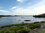
Rodman's Neck (formerly Ann Hook's Neck) refers to a peninsula of land in the New York City borough of the Bronx that juts out into Long Island Sound. The southern third of the peninsula is used as a firing range by the New York City Police Department; the remaining wooded section is part of Pelham Bay Park. The north side is joined to what used to be Hunters Island and Twin Island to form Orchard Beach and a parking lot.Rodman's Neck has three meadows. One is a natural salt water meadow; the other two are manmade freshwater meadows, one of which was created by Robert Moses' projects. The City Island Traffic Circle and several small ballfields also exist, while every original building has been razed. A landfill area for City Island Road crosses Turtle Cove Saltwater Marsh with a culvert made of concrete pipes connecting it to the salt water Eastchester Bay. A second land berm built for horsecars had its always-clogged three foot diameter culvert removed, and a trench with a stainless steel bridge was installed.

Excerpt from the Wikipedia article Rodman's Neck (License: CC BY-SA 3.0, Authors, Images).

Rodman's Neck
Rodmans Neck, New York The Bronx

Geographical coordinates (GPS) Address Nearby Places
placeShow on map

Wikipedia: Rodman's NeckContinue reading on Wikipedia

Geographical coordinates (GPS)

Latitude Longitude
N 40.8525 ° E -73.800555555556 °
placeShow on map

Address

Rodmans Neck

Rodmans Neck
10464 New York, The Bronx
New York, United States
mapOpen on Google Maps

Historic American Buildings Survey, Arnold Moses, Photographer, October 12, 1936, GENERAL VIEW OF EXTERIOR. Marshall House, Rodman's Neck, Bronx, Bronx County, NY HABS NY,3 BRONX,10 1
Share experience

Nearby Places

Pelham Bay Park
Pelham Bay Park

Pelham Bay Park is a municipal park located in the northeast corner of the New York City borough of the Bronx. It is, at 2,772 acres (1,122 ha), the largest public park in New York City. The park is more than three times the size of Manhattan's Central Park. The park is operated by the New York City Department of Parks and Recreation (NYC Parks). Pelham Bay Park contains many geographical features, both natural and man-made. The park includes several peninsulas, including Rodman's Neck, Tallapoosa Point, and the former Hunter and Twin Islands. A lagoon runs through the center of Pelham Bay Park, and Eastchester Bay splits the southwestern corner from the rest of the park. There are also several recreational areas within the park. Orchard Beach runs along Pelham Bay on the park's eastern shore. Two golf courses and various nature trails are located within the park's central section. Other landmarks include the Bartow-Pell Mansion, a city landmark, as well as the Bronx Victory Column & Memorial Grove. Before its creation, the land comprising the current Pelham Bay Park was part of Anne Hutchinson's short-lived dissident colony. Part of New Netherland, it was destroyed in 1643 by a Siwanoy attack in reprisal for the unrelated massacres carried out under Willem Kieft's direction of the Dutch West India Company's New Amsterdam colony. In 1654 an Englishman named Thomas Pell purchased 50,000 acres (200 km²) from the Siwanoy, land which would become known as Pelham Manor after Charles II's 1666 charter. During the American Revolutionary War, the land was a buffer between British-held New York City and rebel-held Westchester, serving as the site of the Battle of Pell's Point, where Massachusetts militia hiding behind stone walls (still visible at one of the park's golf courses) stopped a British advance. The park was created in 1888, under the auspices of the Bronx Parks Department, largely inspired by the vision of John Mullaly, and passed to New York City when the part of the Bronx east of the Bronx River was annexed to the city in 1895. Orchard Beach, one of the city's most popular, was created through the efforts of Robert Moses in the 1930s.

Battle of Pell's Point

The Battle of Pell's Point (October 18, 1776), also known as the Battle of Pelham, was a skirmish fought between British and American troops during the New York and New Jersey campaign of the American Revolutionary War. The conflict took place in what is now part of Pelham Bay Park (namely the Split Rock Golf Course and Pelham Bay Golf Course) in the Bronx, New York City and the towns of Pelham Manor and Pelham in Westchester County, New York. On October 12, British forces landed at Throgs Neck in order to execute a flanking maneuver that would trap Gen. George Washington, commander-in-chief of the American revolutionary forces, and the main body of the Continental Army on the island of Manhattan. The Americans thwarted the landing, and Gen. Sir William Howe, commander-in-chief of British forces in North America, looked for another location along Long Island Sound to disembark his troops. On October 18, he landed 4,000 men at Pelham, 3 miles (4.8 km) north of Throgs Neck. Inland were 750 men of a brigade under the command of the American Col. John Glover. Glover positioned his troops behind a series of stone walls and attacked the British advance units. As the British overran each position, the American troops fell back and reorganized behind the next wall. After several such attacks, the British broke off, and the Americans retreated. The battle delayed British movements long enough for Washington to move the main army to White Plains and avoid being surrounded on Manhattan. After losing to the British in a battle at White Plains, and losing Fort Washington, Washington retreated across New Jersey to Pennsylvania.