place

Sanderstead

1731 establishments in EnglandAreas of LondonCricket grounds in SurreyDefunct cricket grounds in EnglandDefunct sports venues in Surrey
Districts of the London Borough of CroydonEnglish cricket venues in the 18th centurySports venues completed in 1731Use British English from September 2015Villages in Surrey
All Saints' Church, Sanderstead CR2 geograph.org.uk 84937

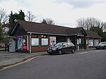
Sanderstead is a village and medieval-founded church parish at the southern end of Croydon in south London, England, within the London Borough of Croydon and the historic county of Surrey. It takes in Purley Downs and Sanderstead Plantation, an area of woodland that includes the second-highest point in London. Sanderstead sits above a dry valley at the edge of the built-up area of Greater London. Cementing its secular identity from the late 19th century until abolition in 1965 it had a civil parish council. The community had a smaller farming-centred economy until the mid 19th century. All Saints' Church's construction began in about 1230 followed by great alterations and affixing of monuments including a poem attributed to John Dryden, the first Poet Laureate nationally; it is protected under UK law as Grade I listed. Sanderstead station is at the foot of the dry valley and has frequent, fast trains to East Croydon, connected to a range of London terminals and interchanges. Sanderstead is claimed to an origin of the English Sanders surname, noting at least four separate geographical clusters formed by the 19th century, two of which were by 1881 far more populous.Sanderstead's Interwar growth coincided with the electrification of the Southern Railway leaving largely a suburban community of households having at least one commuter to central London or Croydon.

Excerpt from the Wikipedia article Sanderstead (License: CC BY-SA 3.0, Authors, Images).

Sanderstead
Shaw Close, London Sanderstead (London Borough of Croydon)

Geographical coordinates (GPS) Address Nearby Places
placeShow on map

Wikipedia: SandersteadContinue reading on Wikipedia

Geographical coordinates (GPS)

Latitude Longitude
N 51.3358 ° E -0.0818 °
placeShow on map

Address

Shaw Close

Shaw Close
CR2 9JD London, Sanderstead (London Borough of Croydon)
England, United Kingdom
mapOpen on Google Maps

All Saints' Church, Sanderstead CR2 geograph.org.uk 84937
Share experience

Nearby Places

London Borough of Croydon

The London Borough of Croydon (pronunciation ) is a London borough in south London, part of Outer London. It covers an area of 87 km2 (33.6 sq mi). It is the southernmost borough of London. At its centre is the historic town of Croydon from which the borough takes its name; while other urban centres include Coulsdon, Purley, South Norwood, Norbury, New Addington and Thornton Heath. Croydon is mentioned in Domesday Book, and from a small market town has expanded into one of the most populous areas on the fringe of London. The borough is now one of London's leading business, financial and cultural centres, and its influence in entertainment and the arts contribute to its status as a major metropolitan centre. Its population is 386,710, making it the second largest London borough and fifteenth largest English district. The borough was formed in 1965 from the merger of the County Borough of Croydon with Coulsdon and Purley Urban District, both of which had been within Surrey. The local authority, Croydon London Borough Council, is now part of London Councils, the local government association for Greater London. The economic strength of Croydon dates back mainly to Croydon Airport which was a major factor in the development of Croydon as a business centre. Once London's main airport for all international flights to and from the capital, it was closed on 30 September 1959 due to the lack of expansion space needed for an airport to serve the growing city. It is now a Grade II listed building and tourist attraction. Croydon Council and its predecessor Croydon Corporation unsuccessfully applied for city status in 1954, 2000, 2002 and 2012. The area is currently going through a large regeneration project called Croydon Vision 2020 which is predicted to attract more businesses and tourists to the area as well as backing Croydon's bid to become "London's Third City" (after the City of London and Westminster). Croydon is mostly urban, though there are large suburban and rural uplands towards the south of the borough. Since 2003, Croydon has been certified as a Fairtrade borough by the Fairtrade Foundation. It was the first London borough to have Fairtrade status which is awarded on certain criteria.The area is one of the hearts of culture in London and the South East of England. Institutions such as the major arts and entertainment centre Fairfield Halls add to the vibrancy of the borough. However, its famous fringe theatre, the Warehouse Theatre, went into administration in 2012 when the council withdrew funding, and the building itself was demolished in 2013. The Croydon Clocktower was opened by Queen Elizabeth II in 1994 as an arts venue featuring a library, the independent David Lean Cinema (closed by the council in 2011 after sixteen years of operating, but now partially reopened on a part-time and volunteer basis) and museum. From 2000 to 2010, Croydon staged an annual summer festival celebrating the area's black and Indian cultural diversity, with audiences reaching over 50,000 people.Premier League football club Crystal Palace F.C. play at Selhurst Park in Selhurst, a stadium they have been based in since 1924. Other landmarks in the borough include Addington Palace, an eighteenth-century mansion which became the official second residence of six Archbishops of Canterbury, Shirley Windmill, one of the few surviving large windmills in Greater London built in the 1850s, and the BRIT School, a creative arts institute run by the BRIT Trust which has produced artists such as Adele, Amy Winehouse and Leona Lewis.