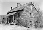
Walhalla, South Carolina

Walhalla is a city in the foothills of the Blue Ridge Mountains in Oconee County, South Carolina. Designated in 1868 as the county seat, it lies within the area of the Blue Ridge Escarpment, an area of transition between mountains and piedmont, and contains numerous waterfalls. It is located 16 miles (26 km) from Clemson University in Clemson, South Carolina. This European-American city was founded after Indian Removal of the Cherokee in 1838. Early residents were predominantly German immigrants who had been refugees from the German revolutions of 1848-1849. Some English and Scots-Irish farmers also settled here. During the Reconstruction era, when Oconee County was organized in 1868, the state legislature designated Walhalla as its county seat.While the population was 4,263 at the 2010 census, "Walhalla" is used both colloquially and practically to refer to a larger area than is within city limits, often being expanded to the whole 29691 zip code. This larger area has a higher, more spread-out population. The current mayor of Walhalla is Danny Edwards.
Excerpt from the Wikipedia article Walhalla, South Carolina (License: CC BY-SA 3.0, Authors, Images).Walhalla, South Carolina
North College Street,
Geographical coordinates (GPS) Address Nearby Places Show on map
Geographical coordinates (GPS)
| Latitude | Longitude |
|---|---|
| N 34.767222222222 ° | E -83.064444444444 ° |
Address
North College Street
29691
South Carolina, United States
Open on Google Maps


