Laurel Bay, South Carolina
Census-designated places in Beaufort County, South CarolinaCensus-designated places in South CarolinaHilton Head Island–Beaufort micropolitan areaPopulated coastal places in South CarolinaPort Royal Island ... and 1 more
Use mdy dates from July 2023

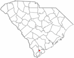
Laurel Bay is a census-designated place and military housing complex in Beaufort County, South Carolina, United States. The population was 5,891 at the 2010 census. As defined by the U.S. Census Bureau, Laurel Bay is included within the Hilton Head Island-Bluffton-Beaufort, SC Metropolitan Statistical Area. The base primarily houses military personnel with families that are stationed at the nearby military bases: MCAS Beaufort, MCRD Parris Island, and USNH Beaufort. The housing area first opened in the mid-1950s.
Excerpt from the Wikipedia article Laurel Bay, South Carolina (License: CC BY-SA 3.0, Authors, Images).Laurel Bay, South Carolina
Misty Drive,
Geographical coordinates (GPS) Address Nearby Places Show on map
 Continue reading on Wikipedia
 Geographical coordinates (GPS)
| Latitude | Longitude |
|---|---|
| N 32.457777777778 ° | E -80.790555555556 ° |
Address
Misty Drive 3340
29906
South Carolina, United States
Open on Google Maps