Circuit Mont-Tremblant
1964 establishments in QuebecBuildings and structures in LaurentidesCanadian Grand PrixChamp Car circuitsFormula One circuits ... and 6 more
Motorsport venues in QuebecRoad racing venues in CanadaSports venues completed in 1964Sports venues in QuebecTourist attractions in LaurentidesUse Canadian English from November 2015

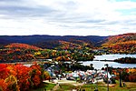
Circuit Mont-Tremblant is a 4.218 km (2.621 mi) race circuit located approximately 130 km (81 mi) north of Montreal, Quebec, in the city of Mont-Tremblant, Canada. It is the second-oldest existing race track in Canada, and was originally known as Circuit Mont-Tremblant-St-Jovite until it was renamed in the 1970s. Set in the shadow of the Mont-Tremblant ski hill, the twisting fifteen-corner track uses the natural topography and elevation of the land.
Excerpt from the Wikipedia article Circuit Mont-Tremblant (License: CC BY-SA 3.0, Authors, Images).Circuit Mont-Tremblant
Diable,
Geographical coordinates (GPS) Address External links Nearby Places Show on map
Geographical coordinates (GPS)
| Latitude | Longitude |
|---|---|
| N 46.187705555556 ° | E -74.609936111111 ° |
Address
Circuit Mont-Tremblant
Diable
J8E 1S5
Quebec, Canada
Open on Google Maps


