place

Ohio River Valley AVA

1983 establishments in the United StatesAmerican Viticultural AreasIndiana wineKentucky wineOhio River
Ohio wineUse mdy dates from April 2021West Virginia wine

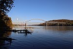
The Ohio River Valley AVA is an American Viticultural Area centered on the Ohio River and surrounding areas. It is the second largest wine appellation of origin in the United States (only the Upper Mississippi Valley is larger) with 16,640,000 acres (26,000 sq mi) (67,300 km2) in portions of the states of Indiana, Kentucky, Ohio and West Virginia. The area is mostly planted with hybrid grapes like Baco noir, Marechal Foch, Seyval blanc and Vidal. Of the Vitis vinifera found in the area Cabernet Franc, Cabernet Sauvignon, Chardonnay, Petit Manseng and Riesling are the most common. The AVA size was decreased by approximately 1,530 square miles when the Indiana Uplands AVA was established in 2013 composed of the bordering area in Indiana.

Excerpt from the Wikipedia article Ohio River Valley AVA (License: CC BY-SA 3.0, Authors).

Ohio River Valley AVA
Ronald Reagan Highway,

Geographical coordinates (GPS) Address Nearby Places
placeShow on map

Wikipedia: Ohio River Valley AVAContinue reading on Wikipedia

Geographical coordinates (GPS)

Latitude Longitude
N 39.10287 ° E -84.81918 °
placeShow on map

Address

Ronald Reagan Highway
41080
Kentucky, United States
mapOpen on Google Maps

Share experience

Nearby Places

Whitewater River (Great Miami River tributary)

The Whitewater River is a 101-mile-long (163 km) southerly flowing right tributary of the Great Miami River in southeastern Indiana and southwestern Ohio in the United States. It is formed by the confluence of two forks, the West Fork and East Fork. The name is a misnomer, as there is no true white water on the river. However, there are many rapids due to the steep gradient present - the river falls an average of six feet per mile (1.1 m/km). The gradient rendered upstream navigation impossible, and in the mid-nineteenth century resulted in the construction of the Whitewater Canal paralleling the river from north of Connersville, Indiana, to the Ohio River. The West Fork, shown as the main stem of the river on federal maps, rises in Randolph County, Indiana, approximately 1 mile (1.6 km) northeast of Modoc. It flows 69.5 miles (111.8 km) south and southeast, past Hagerstown and Connersville, and joins the East Fork of the river at Brookville, Indiana. The 56.7-mile-long (91.2 km) East Fork rises in Darke County, Ohio, approximately 10 miles (16 km) northwest of New Paris. It flows south, through Richmond, Indiana, and joins the West Fork of the river at Brookville, Indiana. From the junction the Whitewater flows southeasterly into Ohio where it eventually joins the Great Miami River, a tributary of the Ohio River. Following continual flooding problems on the East Fork, and to help control flooding in the Ohio River, the East Fork was dammed by the US Army Corps of Engineers to create Brookville Lake in 1974. Brookville Lake extends 17 miles (27 km) from just south of Liberty, Indiana, to Brookville. Cities and towns on the Whitewater River (north to south) include Hagerstown, Cambridge City, Connersville, Laurel, Metamora, Brookville, Harrison (Ohio), and Lawrenceburg. Richmond, Indiana is on the East Fork of the Whitewater River and is the most significant town in the river valley, containing most of the population of the valley. The West Fork of the river is paralleled by State Road 121 from Connersville to 5 miles (8 km) west of Brookville, thence by U.S. Route 52 to the Ohio River.