Pike County Gulch
Marin County, California geography stubsValleys of Marin County, CaliforniaWest Marin
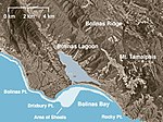
Pike County Gulch is a coastal valley in Marin County, California, United States, which is associated with a small stream. It is located between Wilkins Gulch (to the northwest) and Audubon Canyon (to the southeast). The stream descends the western slope of the Bolinas Ridge, crosses State Route 1 about 3 miles (5 km) north of Stinson Beach, California, and drains into the northern tip of Bolinas Lagoon.The gulch contains an ore vein 4 feet (1.22 m) thick containing pyrite, located a mile (1.6 km) south of the Union Gulch Mine.
Excerpt from the Wikipedia article Pike County Gulch (License: CC BY-SA 3.0, Authors).Pike County Gulch
Shoreline Highway,
Geographical coordinates (GPS) Address Nearby Places Show on map
Geographical coordinates (GPS)
| Latitude | Longitude |
|---|---|
| N 37.931666666667 ° | E -122.68888888889 ° |
Address
Shoreline Highway 4857
94970
California, United States
Open on Google Maps


