place

Battle of Occhiobello

1815 in Italy1815 in the Austrian EmpireApril 1815 eventsBattles involving AustriaBattles involving the Kingdom of Naples
Battles of the Neapolitan WarConflicts in 1815Joachim Murat

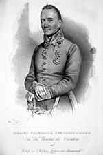
The Battle of Occhiobello was fought on 8 April – 9 April 1815 and was the turning point of the Neapolitan War. Joachim Murat, King of Naples was repulsed by an Austrian force under the command of Johann Frimont whilst trying to cross the bridge over the Po River at Occhiobello. Following the battle, the Austrians would not lose an engagement for the remainder of the war.

Excerpt from the Wikipedia article Battle of Occhiobello (License: CC BY-SA 3.0, Authors).

Battle of Occhiobello
Viadotto Fiume Po, Ferrara

Geographical coordinates (GPS) Address Nearby Places
placeShow on map

Wikipedia: Battle of OcchiobelloContinue reading on Wikipedia

Geographical coordinates (GPS)

Latitude Longitude
N 44.915222222222 ° E 11.579588888889 °
placeShow on map

Address

Viadotto Fiume Po
45039 Ferrara
Emilia-Romagna, Italy
mapOpen on Google Maps

Share experience

Nearby Places

Addizione Erculea
Addizione Erculea

The Addizione Erculea or Erculean Addition is the area of urban expansion created in 1492 by the enlargement of the walled city limits of Ferrara, Italy. It is celebrated as an example of Renaissance urban planning. The walled medieval city of Ferrara was geographically limited from southward expansion by a branch of the delta of the Po river. In 1450, the prior Duke, Borso d'Este (1450) had enlarged slightly the city southward with reclaimed land from the river banks.However, Ercole d'Este had suffered from attacks and sieges from Venice to the north and the Papal states to the South. In 1492, in order to accommodate the burgeoning city and create a more daunting city-fortress to withstand sieges, Ercole d'Este commissioned plans from the architect Biagio Rossetti for an urban expansion north of the city. The walls at this border coincided with the north flank of the Castello Estense. These walls were razed and the moat, present Corso Giovecca, was filled in. Unlike the dense haphazard tracks of the medieval center, the Addizione created a main east-west road (analogous to a Decumanus Maximus) represented now by Corso Porta Po, Biagio Rosetti, and Porta Mare; and north-south street (analogous to a Cardo Maximus) represented by the now Corso Ercole I d'Este parting from the Castello. The Addizione more than doubled the size of the walled town and included areas for cultivation and private parks (now encompassed by the Cemetery of the Certosa and the Jewish cemetery). Among the buildings erected over the next decades and centuries in this sector were the Palazzina di Marfisa d'Este, the church of Santa Chiara, Palazzo Roverella; the Palazzo Prosperi-Sacrati; the church of Teatini; the church of San Carlo, and the 17th century Teatro Comunale.The walls of Ferrara once spanned 13 kilometers, some 9 kilometers still stand, mainly to the north and east of the city. The Porta degli Angeli was an original Northern entrance to the Addizione Erculea.