place

Lohme

LohmeMunicipalities in Mecklenburg-Western PomeraniaTowns and villages on RügenVorpommern-Rügen geography stubs
Lohme Hafen 2
Lohme Hafen 2

Lohme is a municipality in the Vorpommern-Rügen district, in Mecklenburg-Vorpommern, Germany.

Excerpt from the Wikipedia article Lohme (License: CC BY-SA 3.0, Authors, Images).

Lohme
Pfad zum Strand, Nord-Rügen

Geographical coordinates (GPS) Address Nearby Places
placeShow on map

Wikipedia: LohmeContinue reading on Wikipedia

Geographical coordinates (GPS)

Latitude Longitude
N 54.583333333333 ° E 13.6 °
placeShow on map

Address

Pfad zum Strand

Pfad zum Strand
18551 Nord-Rügen
Mecklenburg-Vorpommern, Germany
mapOpen on Google Maps

Lohme Hafen 2
Lohme Hafen 2
Share experience

Nearby Places

Nardevitz Erratic
Nardevitz Erratic

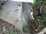
The Nardevitz Erratic (German: Findling Nardevitz), also called the Great Rock of Nardewitz (Großer Stein von Nardevitz), is one of the largest glacial erratics in North Germany. It lies about 400 metres north of Nardevitz, a village in the parish of Lohme on the island of Rügen. Surrounded by trees and bushes as well as other drift material that was in the way of farming, it lies in the middle of a field. Its volume is estimated at 104 m³, which gives it a mass of 281 tonnes. The above-ground portion has a volume of 71 m³. It is therefore, apart from Buskam which lies in the Baltic Sea off Göhren, the largest erratic on Rügen and an important geological sight. Because the Nardevitz Erratic was used for a long time to obtain construction material, it is suspected today that it was once three times its present size. For example, in 1854 and 1855, column drums weighing about five tonne and pedestal blocks, up to 2 tonnes in weight, for the Prussian Columns near Neukamp and Groß Stresow were hewn from the rock. On the rock itself there are clear traces that show there were plans for further destruction of the erratic. Today the Nardevitz Rock, like around 20 other erratics on the island of Rügen, is one of its legally-protected geotopes. It is recorded in the relevant register at the Mecklenburg-Vorpommern State Office for the Environment, Conservation and Geology (Landesamt für Umwelt, Naturschutz und Geologie Mecklenburg-Vorpommern) as entry "G2 75".

Königsstuhl (Rügen)
Königsstuhl (Rügen)

Königsstuhl (King's Chair) is the best-known chalk cliff on the Stubbenkammer in Jasmund National Park on the Baltic Sea island of Rügen. It lies at 118 m above sea level (NN). In 2004, Königsstuhl was incorporated into the terrain of Königsstuhl National Park Centre. It can be reached along a cliff top path, 11 kilometres (6.8 mi) long in total, that runs from Sassnitz to Lohme, or from the large car park in Hagen (in the municipality of Lohme) 3 km (1.9 mi) away. Since 2004, entry to the National Park Centre, and hence access to Königsstuhl, has been subject to a charge. The narrow yet massive granite steps that lead to the plateau on Königsstuhl, 200 m2 (2,200 sq ft) in area, lie over the site of what is suspected to be a Bronze Age barrow. From the plateau there is a sweeping view of the Baltic Sea. Königsstuhl itself is best seen from the viewing point of Victoria View (Victoria-Sicht) to the south. There is a legend that the name Königsstuhl ("King's Chair") goes back to an event in 1715 when the Swedish king Charles XII is supposed to have commanded a sea battle against the Danes from this spot. The battle tired the ruler so much that he needed to take a chair. However, the name Königsstuhl was used in a travel report by the vicar, Rhenan, in 1586, who had been tasked by the Pomeranian duke to find mineral springs; thus it is clear that it had been named much earlier. According to a legend, the name is actually derived from a custom whereby in ancient times the person elected king was the first to climb the cliffs from the sea and sit in the chair on the top.